

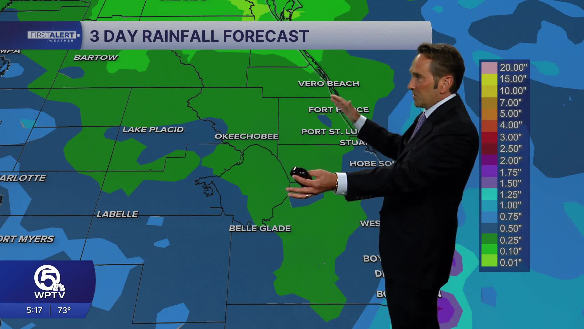


WEST PALM BEACH, Fla. — South Florida is experiencing a shift in weather patterns as increasing moisture returns to the region, marking the end of recent drier conditions. Tuesday signals the beginning of this transition with a dynamic mix of clouds and sunshine punctuated by scattered afternoon showers and thunderstorms. Some of these storms have the potential to produce heavy downpours and gusty winds that could create localized hazards for outdoor activities and travel.
The wetter pattern becomes increasingly evident Wednesday as more numerous showers and thunderstorms develop across the region. Rain coverage will be notably higher than Tuesday's scattered activity, with some locations experiencing periods of locally heavy rainfall that could overwhelm drainage systems in flood-prone areas.
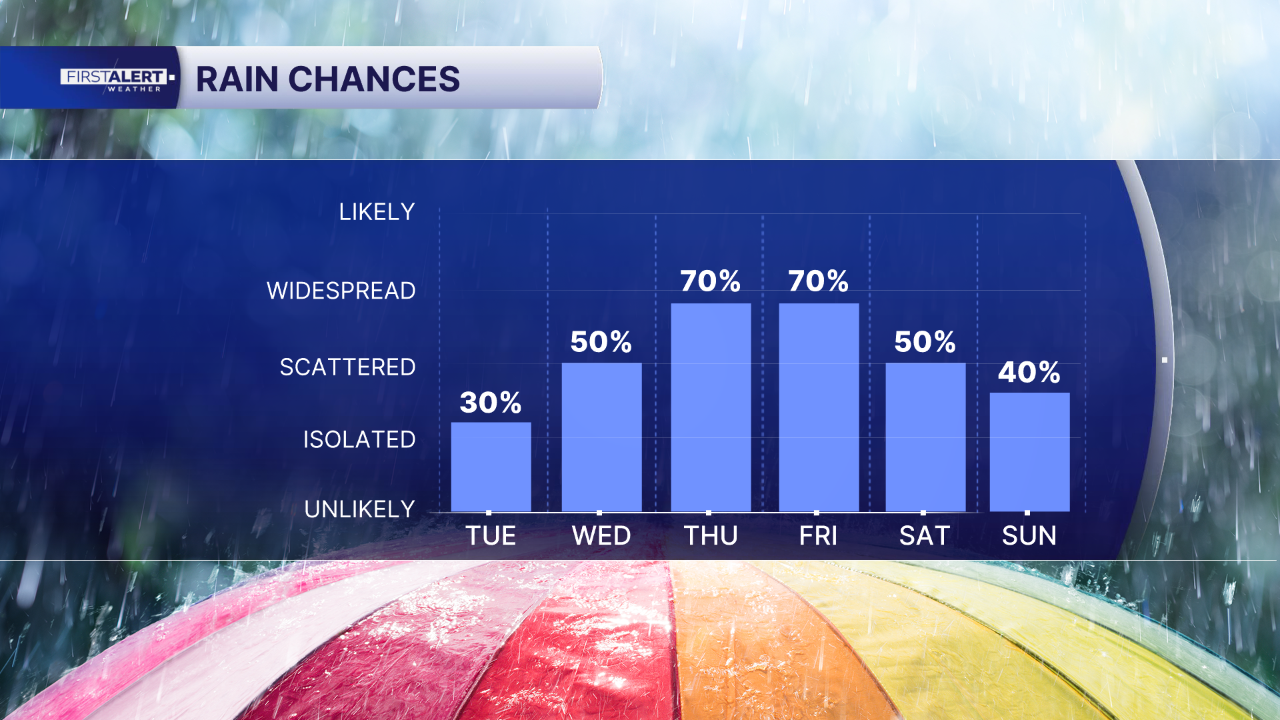
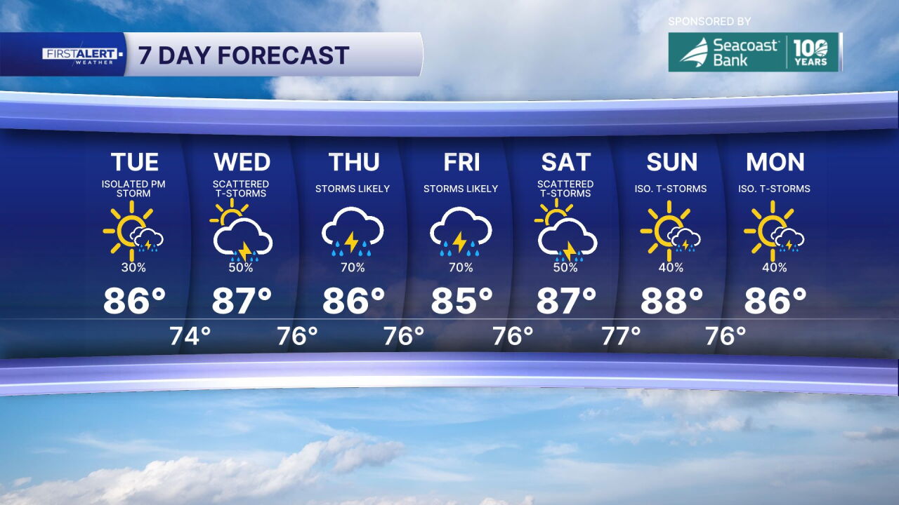
Thursday through Friday will feature the wettest conditions of the week with multiple rounds of showers and storms expected. Heavy downpours during this time frame could temporarily slow traffic and cause significant ponding on roadways, creating hazardous driving conditions throughout the region. Humidity levels will remain persistently high while temperatures hold steady in the mid to upper 80s, creating an oppressive combination that will make outdoor conditions particularly uncomfortable.
Weekend conditions show little immediate relief as rain chances remain elevated, though periodic breaks in the wet weather should provide some respite from the continuous activity. The overall pattern will remain humid and unsettled with scattered showers and thunderstorms continuing to pose intermittent threats to outdoor plans.
MORE WEATHER: Radar | Alerts | 7-Day Forecast | Hourly Forecast
**Portions of this story were assisted by artificial intelligence tools and reviewed by a WPTV journalist to ensure accuracy, clarity, and adherence to editorial standards.


