




WEST PALM BEACH, Fla. — A very wet pattern is setting up through the middle of the week as deep tropical moisture surges into South Florida. The atmosphere will support repeated rounds of showers and thunderstorms, and some areas could pick up several inches of rain where storms repeatedly track over the same locations. The National Weather Service is also highlighting the risk of intense rainfall rates and localized flooding, particularly along the east coast.
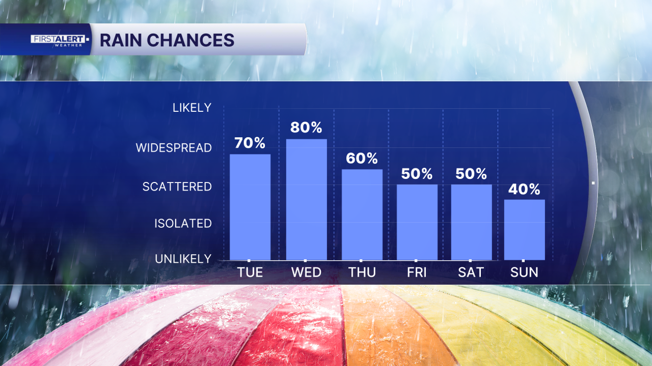
Today: Expect a warm, humid start with increasing cloud cover. Rain chances climb this afternoon, with scattered to numerous showers and thunderstorms developing. Some storms may bring torrential downpours, frequent lightning, and gusty winds. Around West Palm Beach, rain chances are near 60%.
Wednesday: This appears to be one of the wettest days of the week. Numerous showers and thunderstorms are expected throughout the day, with periods of heavy rainfall. Repeated downpours could lead to flooding on poorly drained roads and low-lying areas.
Thursday: The unsettled pattern continues, with widespread showers and thunderstorms likely. Rather than a typical afternoon storm, expect the possibility of multiple rounds of rain throughout the day. Rain chances remain around 90% near West Palm Beach.
Friday: Conditions stay active, though the pattern should begin to gradually ease. Showers and thunderstorms remain likely, especially during the afternoon, but overall rain coverage is expected to start trending lower.
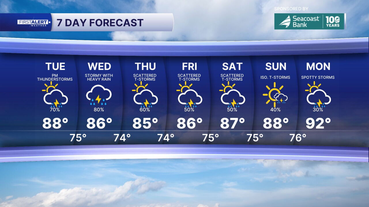
Weekend: Drier weather slowly returns. Scattered showers and thunderstorms are still possible Saturday, but Sunday looks noticeably improved, with only isolated rain chances and more dry time.
MORE WEATHER: Radar | Alerts | 7-Day Forecast | Hourly Forecast
Portions of this story were assisted by artificial intelligence tools and reviewed by WPTV journalists to ensure accuracy, clarity, and adherence to editorial standards.


