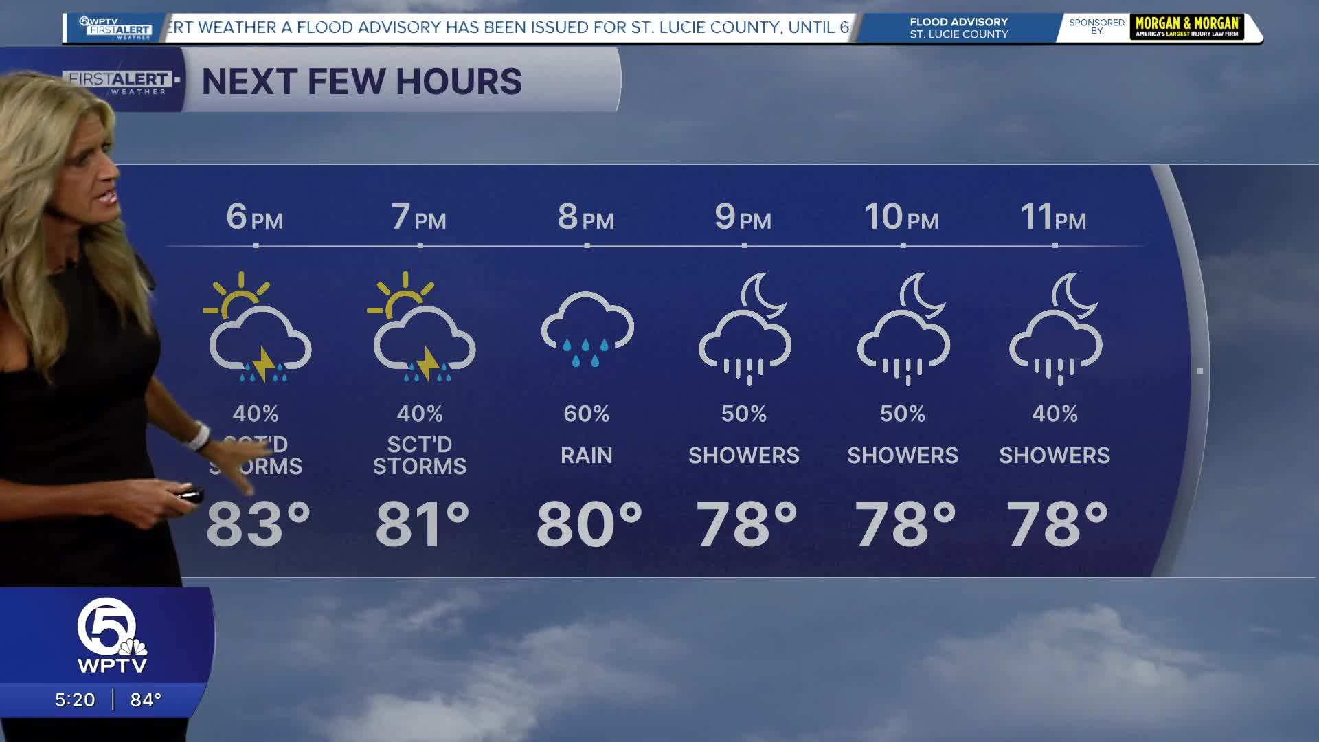
Weather

Actions

FORECAST: Risk for severe storms this afternoon, temps to feel near 100 degrees

WPTV First Alert Weather Forecast for morning of Tuesday, May 12, 2026
Weather May 12, 2026
Posted

WEST PALM BEACH, Fla. — South Florida is in for another hot, stormy afternoon today as a slow-moving weather system lingers across the region. Temperatures will climb into the upper 80s and low 90s, but the humidity will make it feel closer to 100 degrees in many areas.

Storm development may hold off until the afternoon, but once storms form, they could quickly become widespread — especially across inland areas, around Lake Okeechobee, and eventually along the east coast metro by early evening as they push back toward the coast, then offshore.

Severe weather risk May 12, 2026

Some of today’s thunderstorms could produce strong wind gusts, frequent lightning, and torrential downpours. Forecasters say the atmosphere is loaded with tropical moisture, which means storms will be capable of dumping heavy rain in a short amount of time. Because winds higher in the atmosphere will be weak, storms may move slowly, increasing the risk for isolated urban flooding, particularly in flood-prone East Coast neighborhoods during the evening commute.

The unsettled pattern continues on Wednesday with another round of scattered afternoon and evening storms expected. After that, South Florida should gradually transition into a slightly drier setup heading into the end of the week and weekend, although typical sea breeze storms will remain possible each afternoon.

Rain chances May 12, 2026

Temperatures are expected to stay above average through the extended forecast, with highs generally in the upper 80s to low 90s and warm, muggy nights continuing.

7-day forecast May 12, 2026

MORE WEATHER: Radar | Alerts | 7-Day Forecast | Hourly Forecast

**Portions of this story were assisted by artificial intelligence tools and reviewed by a WPTV journalist to ensure accuracy, clarity, and adherence to editorial standards.