
Weather

Actions

FORECAST: Prepare for a rainy, muggy Labor Day weekend

Scattered to numerous thunderstorms are expected today, with heat index values potentially reaching 107°F and a wet pattern continuing through the holiday weekend
HRRR EXTENDED.png
Posted
and last updated

WEST PALM BEACH, Fla. — A hot, humid and increasingly stormy weather pattern continues across the Palm Beaches and Treasure Coast today. Plenty of tropical moisture is in place, meaning even brief periods of sunshine will leave the atmosphere primed for thunderstorms.

Expect a mix of clouds and sunshine with scattered to numerous showers and thunderstorms, especially from late morning through the afternoon. Some storms could become locally strong, producing very heavy rain, frequent lightning, gusty winds and brief periods of poor visibility. Some areas could receive enough rain quickly to cause temporary street flooding.

Rain Chances Sept. 3, 2026

Temperatures should reach the upper 80s to around 91°F, but humidity will make it feel considerably hotter. Heat index values could reach around 105–107°F, particularly where sunshine breaks out before storms develop.

Tonight will remain warm and muggy, with additional showers or thunderstorms possible. Lows will generally stay in the upper 70s to around 80°F.

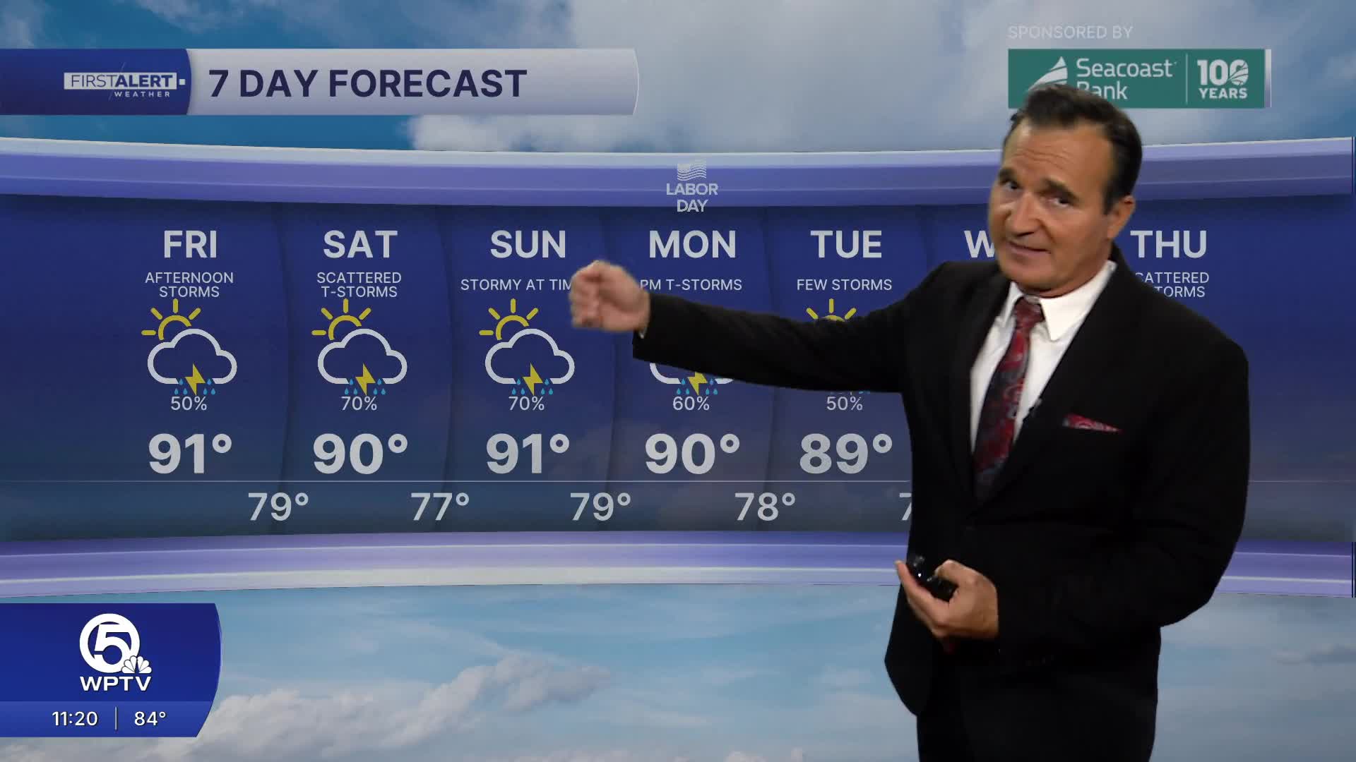
The wet pattern is expected to continue through the holiday weekend. Friday through Labor Day looks quite stormy, with repeated downpours possible. Rainfall could be locally heavy, so flooding of poorly drained roads will remain a concern.

7-day forecast Sept. 3, 2026

MORE WEATHER: Radar | Alerts | 7-Day Forecast | Hourly Forecast

**Portions of this story were assisted by artificial intelligence tools and reviewed by a WPTV journalist to ensure accuracy, clarity, and adherence to editorial standards.