

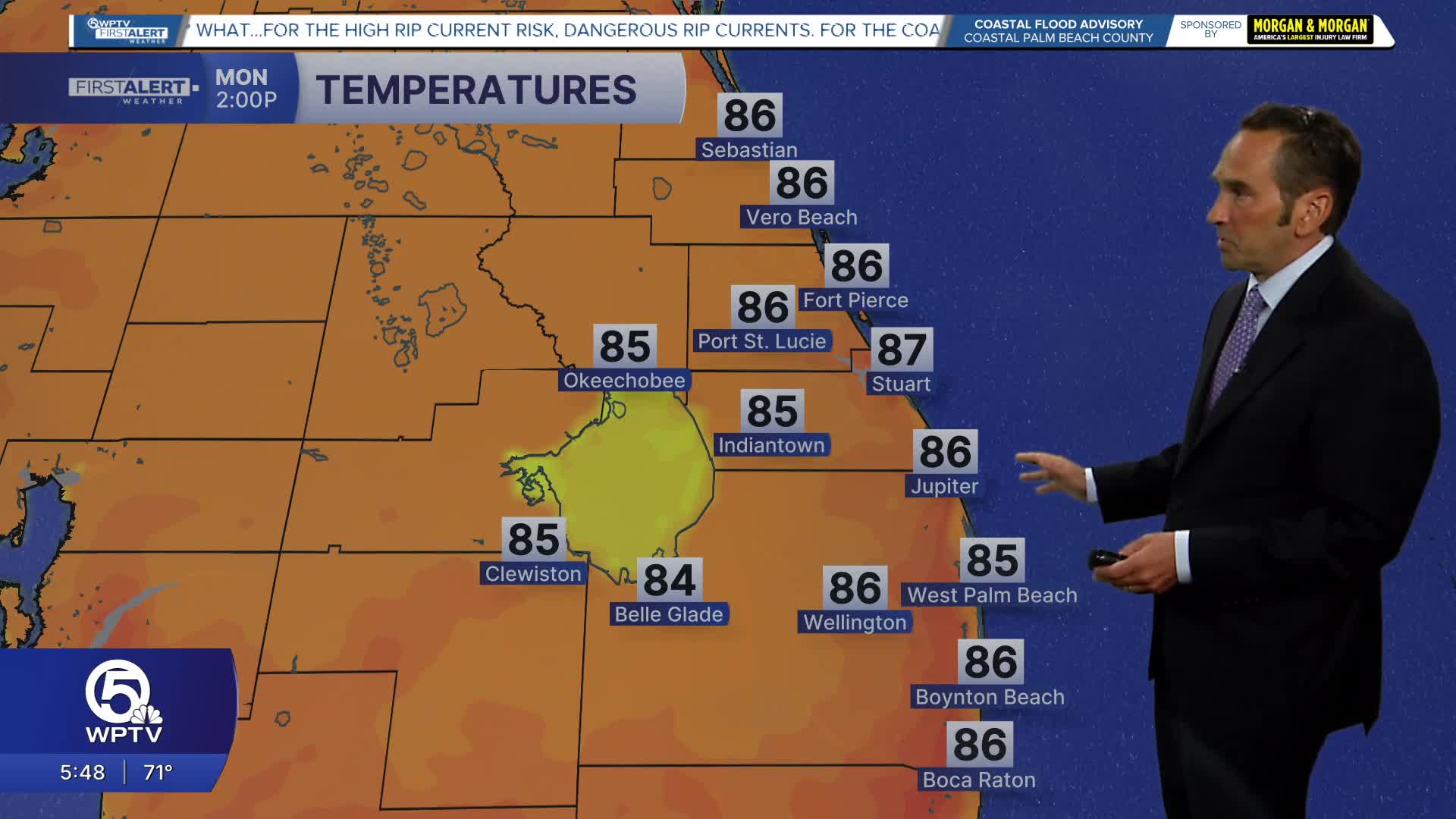


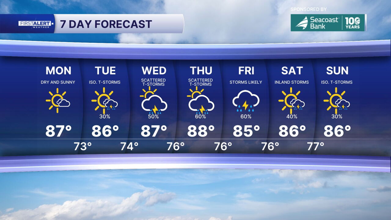
WEST PALM BEACH, Fla. — The Treasure Coast and Palm Beaches begin the week with relatively pleasant conditions before transitioning to a wetter pattern by midweek. Today features partly sunny to mostly cloudy skies with temperatures in the upper 80s and only isolated shower chances.
Tuesday brings increasing clouds with scattered afternoon and evening showers and thunderstorms. Highs remain in the mid to upper 80s as the weather pattern begins shifting toward more unsettled conditions.
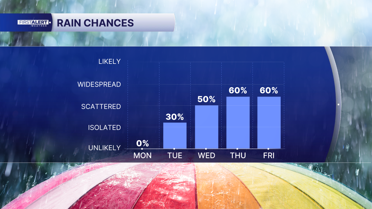
Wednesday marks a significant change as rain chances increase substantially across the region. Expect more widespread showers and thunderstorms with locally heavy downpours possible. Humidity remains elevated while highs moderate to the mid-80s, creating uncomfortable outdoor conditions.
The unsettled pattern continues Thursday into Friday with additional rounds of showers and thunderstorms accompanied by developing breezier conditions that could create hazardous driving during periods of heaviest rainfall.
Beach conditions present immediate safety concerns throughout the week, particularly early on. The National Weather Service has issued a high rip-current risk advisory for Atlantic beaches, warning of dangerous currents capable of pulling swimmers away from shore. These invisible underwater currents can develop quickly without warning, making them especially hazardous for unsuspecting beachgoers.
**Portions of this story were assisted by artificial intelligence tools and reviewed by a WPTV journalist to ensure accuracy, clarity, and adherence to editorial standards.
MORE WEATHER: Radar | Alerts | 7-Day Forecast | Hourly Forecast


