
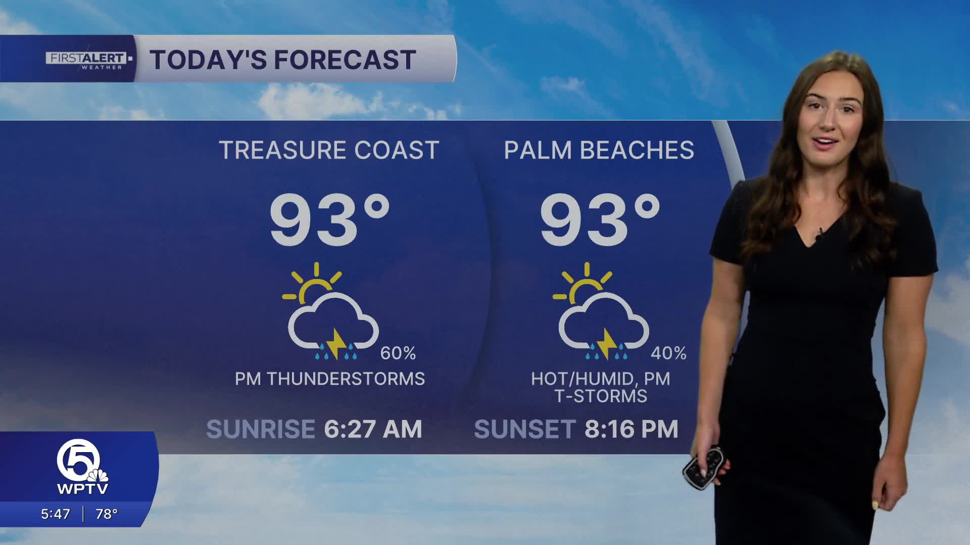


WEST PALM BEACH, Fla. — Some sunshine to start your day, followed by scattered thunderstorms this afternoon into the early evening, mainly across Palm Beach County.
Rain chances will be driven by daytime sea‑breeze convection, so the timing looks to be in the afternoon starting after 1 PM. Some storms could produce heavy downpours that lead to localized urban and poor‑drainage flooding. Avoid driving through flooded streets. Storms look to taper off later this evening.

Temperatures are forecast to stay above normal for the remainder of the week with highs in the lower-mid 90s.
Heat‑index values are expected to approach advisory levels each day. Feels‑like temperatures could peak between around 105°F -108°F — nearing heat advisory status if storms do not move in to provide temporary relief. Take precautions by staying hydrated, limiting outdoor exertion during the hottest parts of the day.
Overnight hours should be relatively quiet, but remain very muggy.

Rain chances decrease for Wednesday and Thursday before ramping up prior to the weekend.
MORE WEATHER: Radar | Alerts | 7-Day Forecast | Hourly Forecast
**Portions of this story were assisted by artificial intelligence tools and reviewed by a WPTV journalists to ensure accuracy, clarity, and adherence to editorial standards.


