



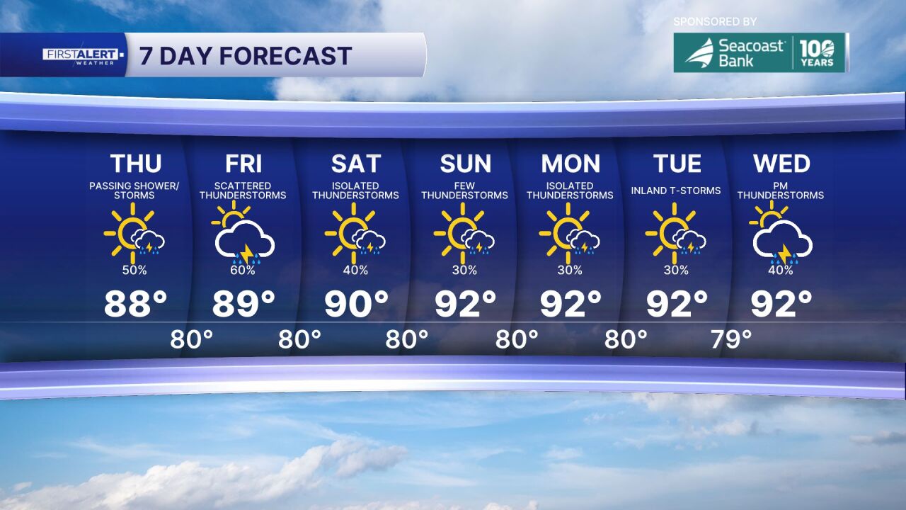
WEST PALM BEACH, Fla. — Expect some showers and a few thunderstorms across the Treasure Coast and the Palm Beaches, with warm, humid conditions from sunrise through the afternoon. Skies will feature a mix of sunshine and clouds, allowing temperatures to climb into the upper 80s to lower 90s, while the heat index will make it feel closer to the upper 90s at times.
The better chance for scattered showers and thunderstorms will come during the afternoon and early evening as the sea breeze moves inland. Some storms could produce torrential downpours, frequent lightning, gusty winds, and localized street flooding in poor drainage areas. Rainfall will be uneven, with some neighborhoods staying mostly dry while others receive heavy rain in a short period.
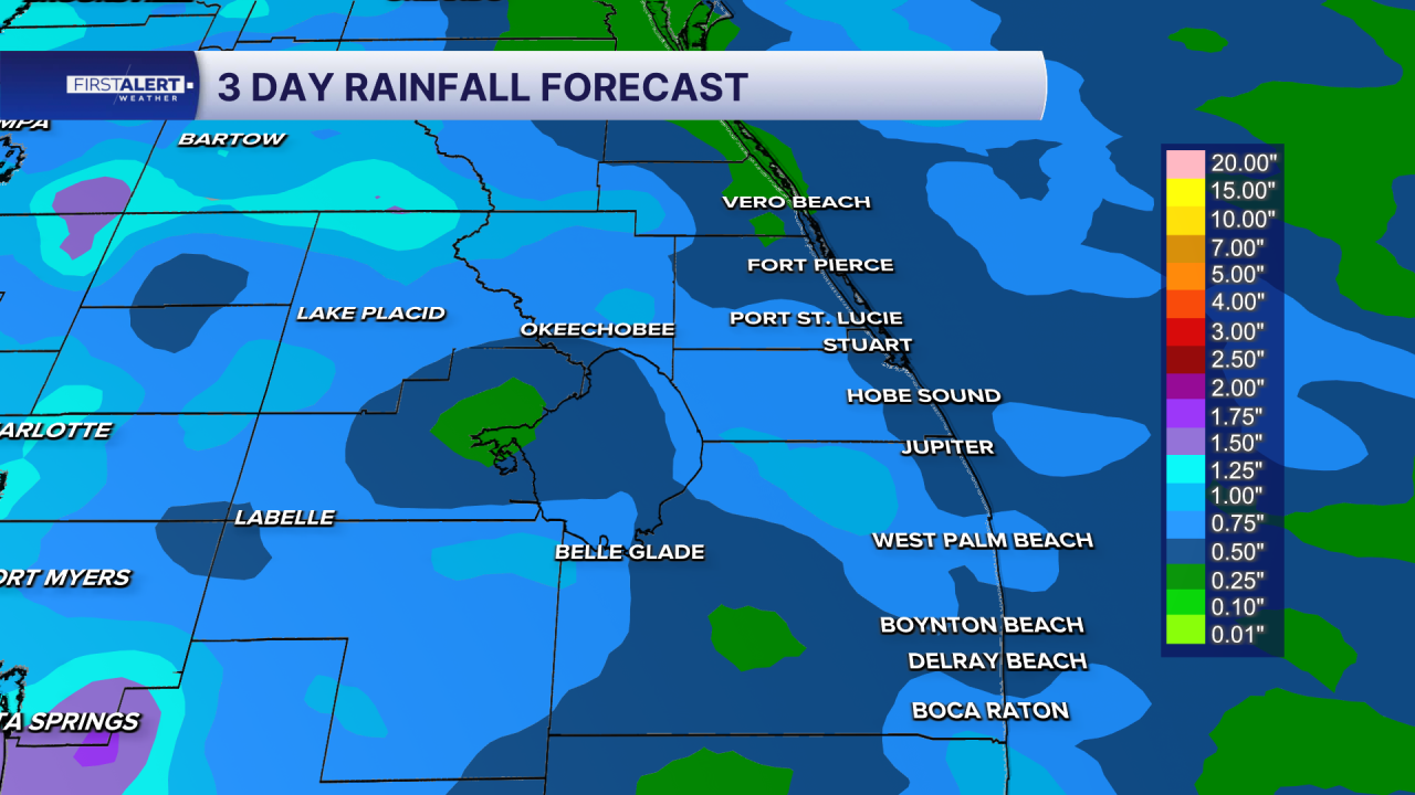
Winds will generally be from the southeast at 10 to 15 mph, helping to keep the immediate coastline slightly cooler than inland communities. Overnight, storms will gradually diminish, leaving partly cloudy skies with warm and muggy conditions. Lows will settle into the mid to upper 70s.
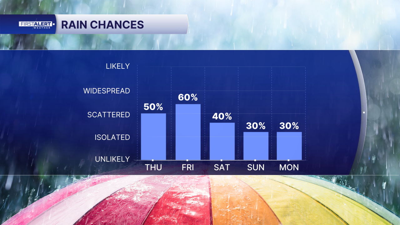
Looking ahead to Friday and the weekend, the atmosphere remains very moist, bringing an increased chance of afternoon and evening thunderstorms each day. Heavy rain and localized flooding will remain the primary concerns, while temperatures continue to top out near 90 degrees with tropical humidity.
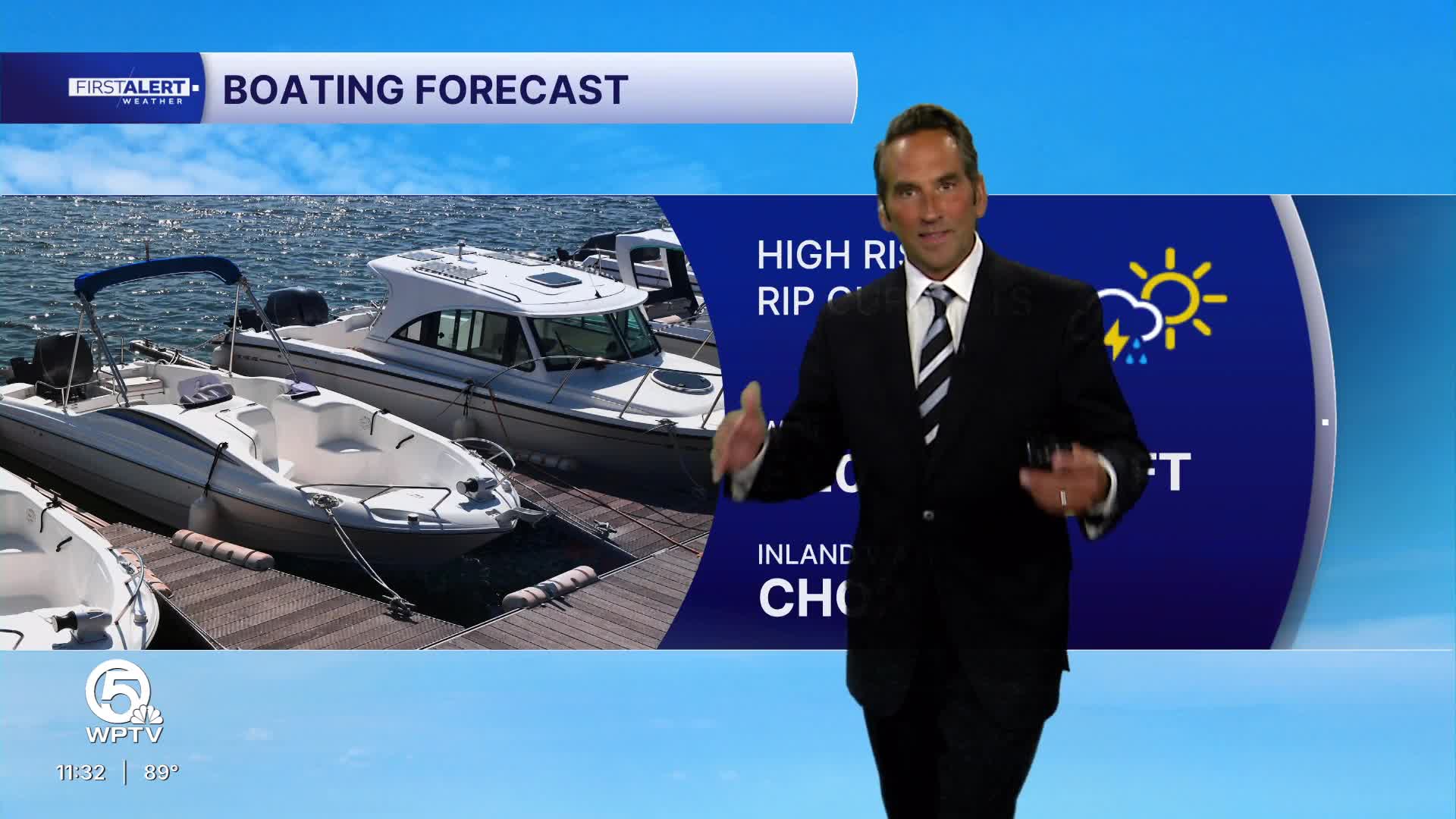
An uptick in waves and surf will create a high risk of rip currents through Saturday. Stronger easterly winds will make the coast pretty rough so swim near life gaurds and remember to swim along the coast not towards the shore if caught in a rip current.
MORE WEATHER: Radar | Alerts | 7-Day Forecast | Hourly Forecast
**Portions of this story were assisted by artificial intelligence tools and reviewed by a WPTV journalist to ensure accuracy, clarity, and adherence to editorial standards.


