
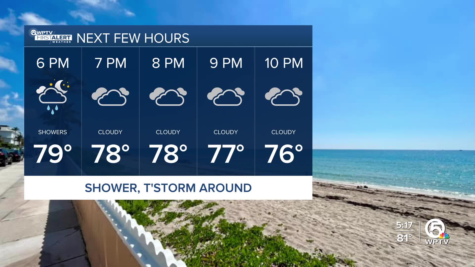


WEST PALM BEACH, Fla. — Afternoon highs will top the mid-80s, plus a few showers and isolated storms are possible with more moisture in the atmosphere.
As the cold front enters North Florida today, the wind flow in our areas will turn southwesterly this Wednesday, helping to increase humidity.
MORE WEATHER: Radar | Alerts | 7-Day Forecast | Hourly Forecast
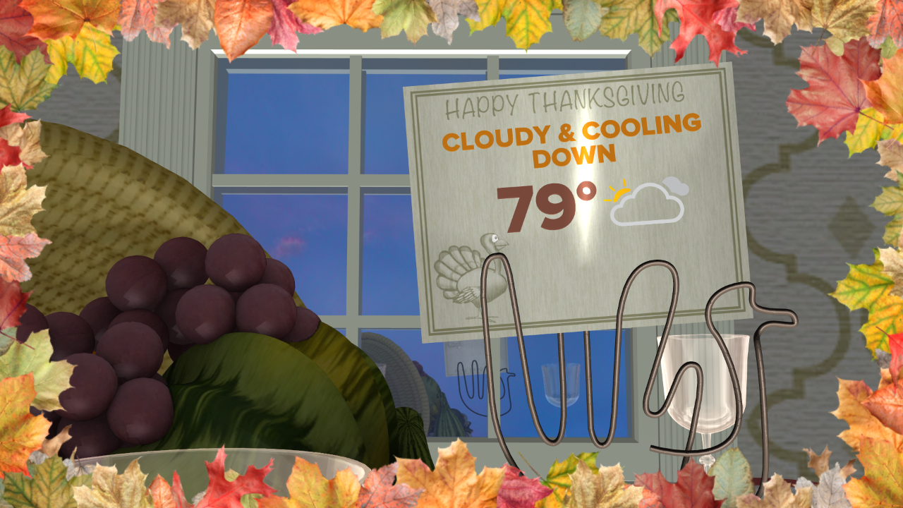
A cold front will sweep through on Thanksgiving Day, allowing for cooler air to filter in throughout the day. High temperatures on Thursday will be in the upper 70s or near 80 degrees.
Anticipate a chilly Friday morning with lows in the upper 50s, with some upper 40s possible north of Lake Okeechobee. A brisk wind will keep highs in the upper 60s to lower 70s on Friday afternoon.
High pressure builds back in for the weekend, shifting winds onshore and gradually warming temperatures again, and it stays breezy. Highs rebound to the middle 70s Saturday and climb toward the upper 70s to near 80 degrees by Sunday.
Traveling by plane for the weekend? Here's what you should know:
Wednesday's travel by air will be a mess of delays in the Midwest and Great Lakes areas. Chicago airports could major delays for travelers as snow and high winds will impact the area.
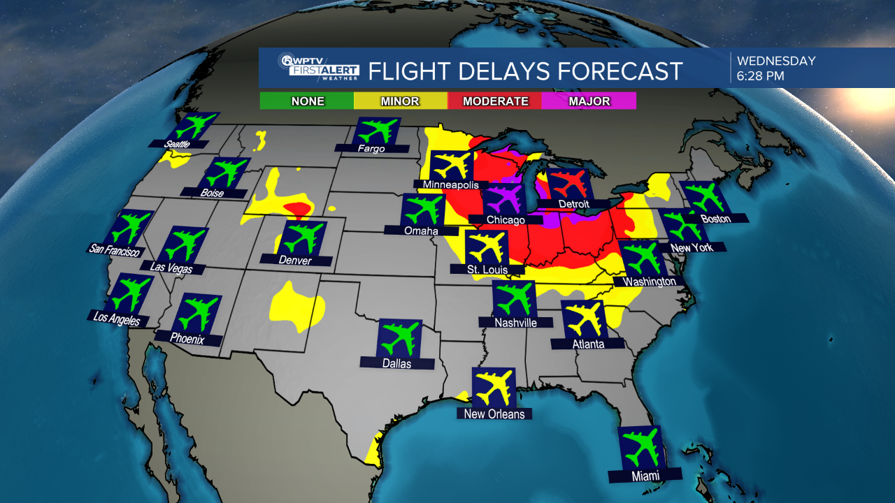
Rainy conditions are expected for the Northeast and Mid-Atlantic states throughout Wednesday, while sunshine returns to the south from Texas to Georgia. In the West Coast, quiet weather conditions for California and the Desert Southwest, but rain and snow, at high levels, will impact the Pacific Northwest.


