
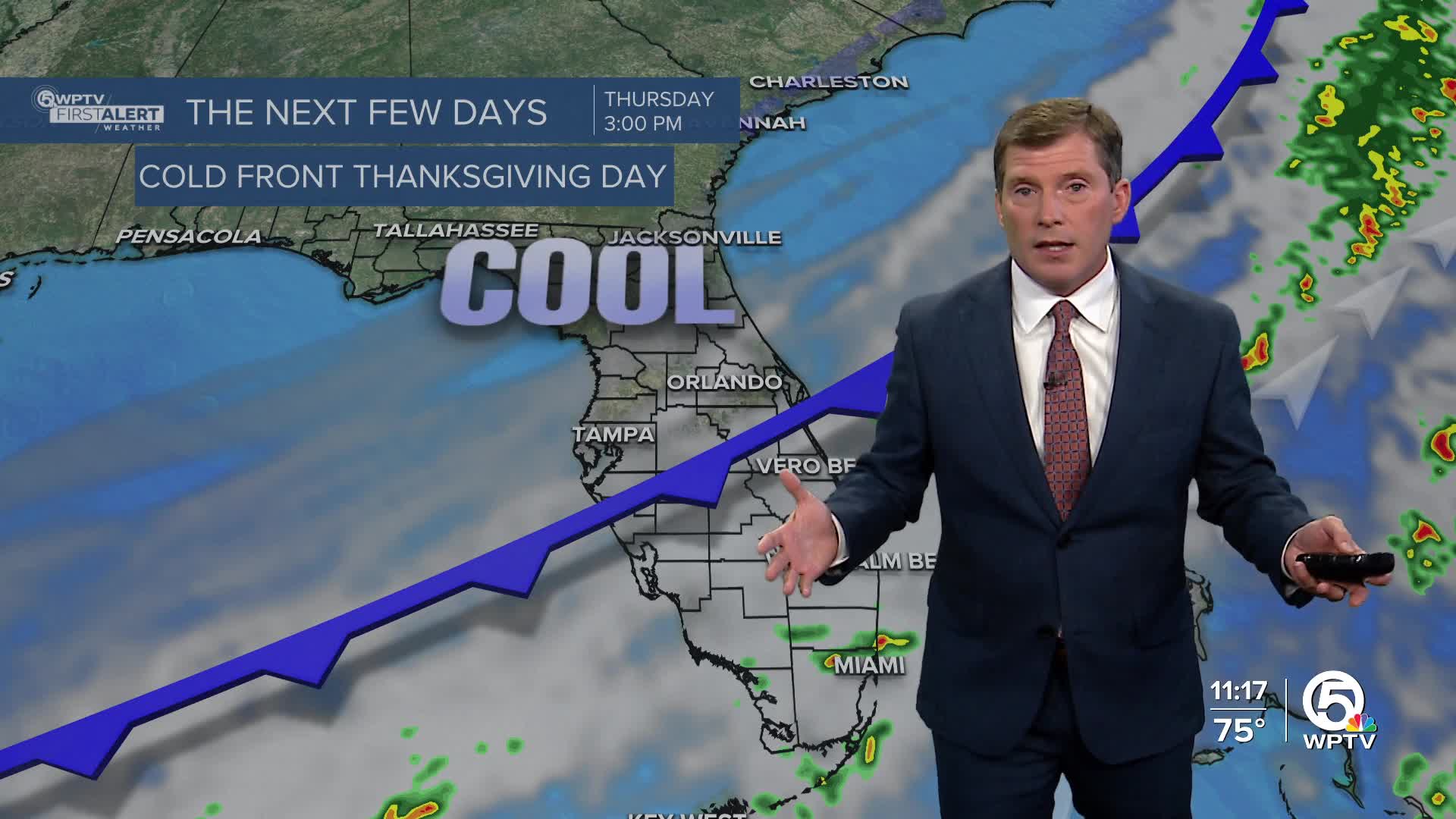


WEST PALM BEACH, Fla. — High pressure continues to dominate our pattern, keeping temperatures above normal with afternoon highs in the low to mid-80s through Wednesday. It will feel more humid by Wednesday afternoon as the cold front moves over North Florida.
MORE WEATHER: Radar | Alerts | 7-Day Forecast | Hourly Forecast
Stray showers or storms are possible on Wednesday night. The cold front passes through the Treasure Coast and the Palm Beaches on Thanksgiving Day with lots of clouds and minimal moisture.
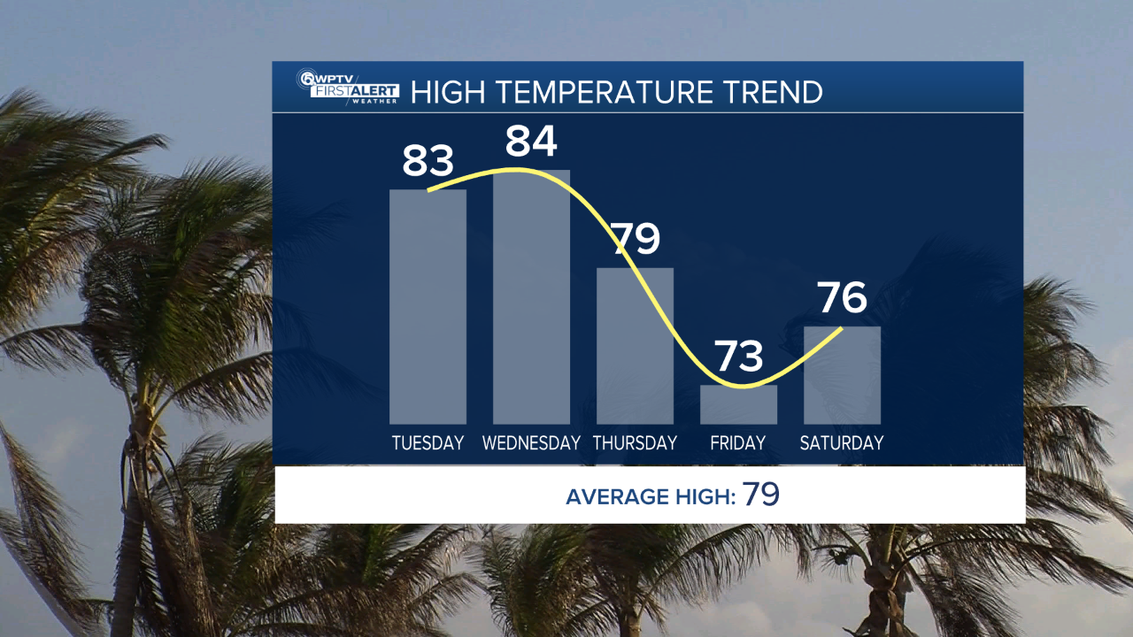
Noticeably cooler temps arrive Thursday. High temps will range from the mid-70s to the lower 80s.
Even cooler air is settling in on Friday as breezy north-northeast winds keep highs in the upper 60s to lower 70s. Lows will dip into the 50s to lower 60s Thursday and Friday nights, with some upper 40s possible north of Lake Okeechobee.
By the weekend, high pressure builds back in, shifting winds onshore and gradually warming temperatures again, and it stays breezy. Highs rebound to the middle 70s Saturday and climb toward the upper 70s to near 80 degrees by Sunday.


