

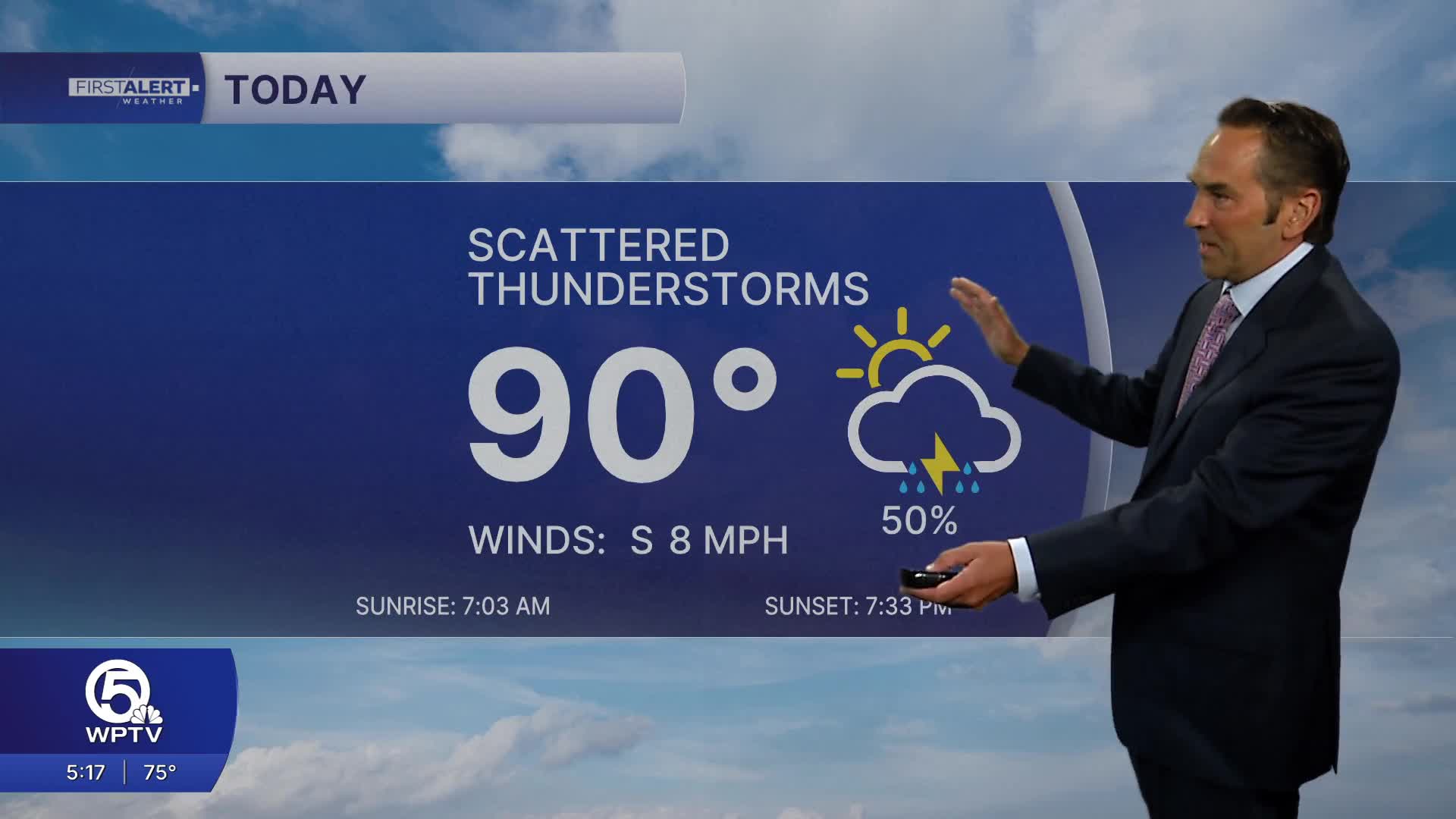


WEST PALM BEACH, Fla. — Today will be a very warm, humid, and somewhat stormy day across the Treasure Coast and Palm Beaches. Expect a mix of sunshine and clouds this morning, with temperatures quickly climbing through the 80s.
By early to mid-afternoon, scattered showers and thunderstorms will become more numerous. The storms will not cover everyone, but where they develop, they could produce very heavy downpours, frequent lightning, gusty winds, and brief street flooding. Yesterday’s severe weather is a reminder that a few storms can become strong.
High temperatures will generally reach the upper 80s to around 90 degrees, with heat-index values approaching or exceeding 100 degrees in spots. It will remain muggy even after storms pass.
Tonight stays warm and humid, with a few additional showers or thunderstorms possible. Lows will be mainly in the upper 70s to around 80.
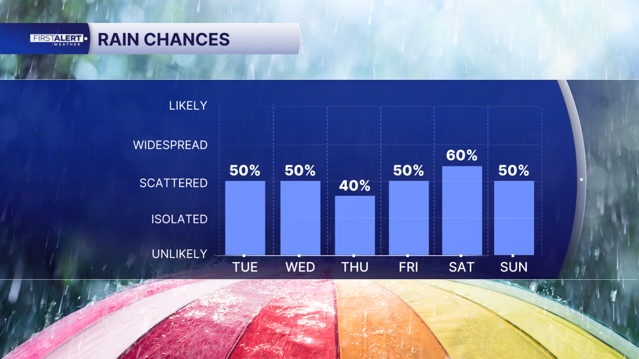
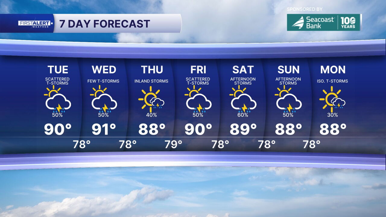
The unsettled pattern continues throughout the week. Wednesday may feature more sunshine and somewhat fewer storms, but showers and thunderstorms remain possible. Storm chances increase again Thursday and Friday, with the best opportunities generally during the afternoon and early evening. Temperatures remain hot, mostly upper 80s to lower 90s.
MORE WEATHER: Radar | Alerts | 7-Day Forecast | Hourly Forecast
**Portions of this story were assisted by artificial intelligence tools and reviewed by a WPTV journalist to ensure accuracy, clarity, and adherence to editorial standards.


