

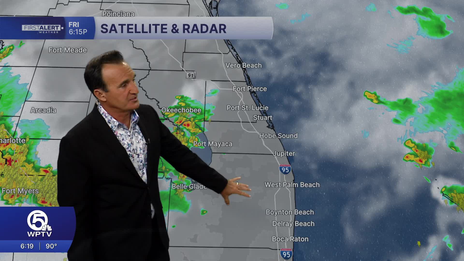


WEST PALM BEACH, Fla. — Today will be the wettest day so far this week— expect widespread showers and thunderstorms developing through the morning and afternoon, with periods of heavy rainfall, frequent lightning, and localized street flooding. Some storms could produce gusty winds, and outdoor plans are likely to be interrupted. High temperatures will reach the upper 80s to around 90 degrees due to increased cloud cover.
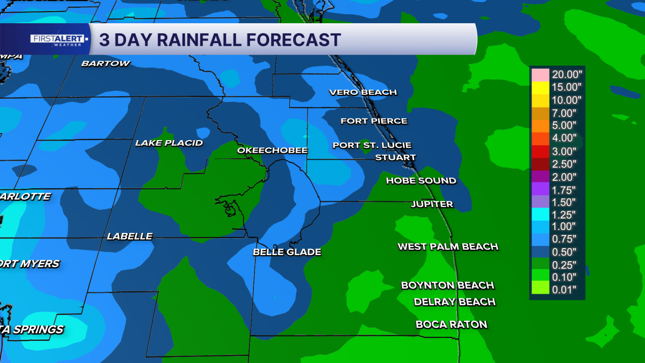
Saturday brings a slight decrease in rain coverage, but scattered afternoon and evening thunderstorms will still develop after a hot and humid start. Highs will climb into the lower 90s, with heat index values approaching or exceeding 100 degrees before storms form.
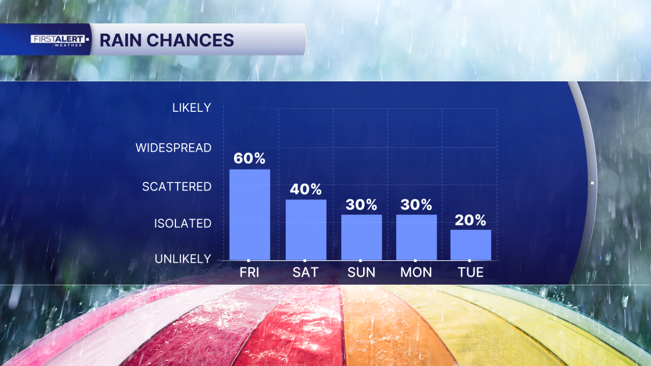
Sunday looks to be the driest day of the weekend. Sunshine will be more prevalent through the morning and early afternoon, with only isolated to scattered thunderstorms developing later in the day. Many locations should stay dry, making it the best day for outdoor activities, although a brief afternoon storm cannot be ruled out.
MORE WEATHER: Radar | Alerts | 7-Day Forecast | Hourly Forecast

**Portions of this story were assisted by artificial intelligence tools and reviewed by a WPTV journalist to ensure accuracy, clarity, and adherence to editorial standards.


