

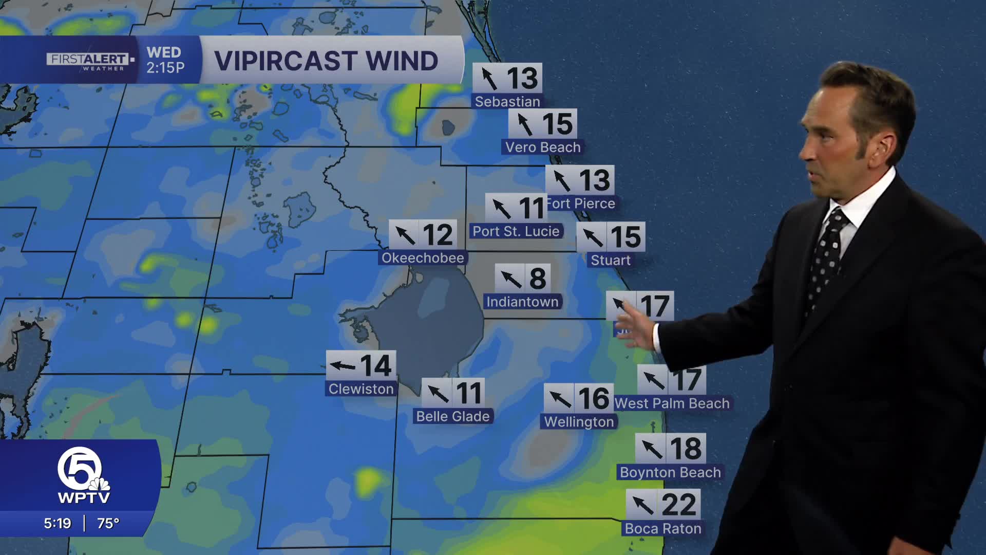


WEST PALM BEACH, Fla. — South Florida faces a progressively wetter weather pattern beginning today, with conditions becoming increasingly unsettled through the end of the week.
Today's forecast calls for a mix of clouds and sunshine as scattered showers and thunderstorms develop, particularly during afternoon hours when atmospheric instability peaks. The Palm Beaches face approximately a 60% chance of rainfall, while the Treasure Coast begins with more modest rain chances early in the day before probabilities increase as the weather pattern evolves. Temperatures will generally reach the mid to upper 80s as humidity levels climb back to more oppressive summer-like conditions.
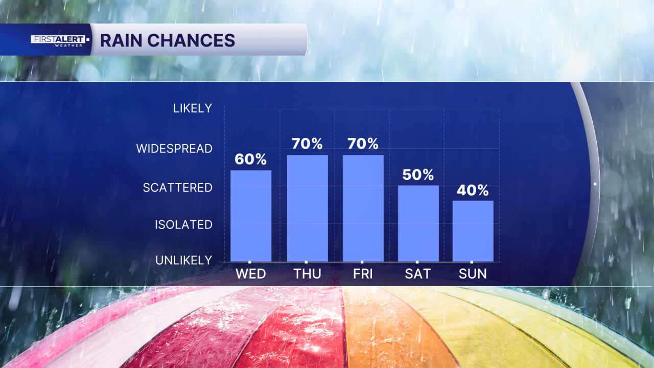
Thursday, showers and thunderstorms become considerably more numerous across the entire region. Periods of locally heavy rainfall become increasingly likely, creating potential concerns for areas prone to poor drainage and flooding. East to southeast winds will strengthen throughout the day, drawing additional moisture from the Atlantic and making coastal areas particularly susceptible to heavier precipitation and more persistent storm activity.
Friday continues the trend toward more active weather with another day dominated by widespread shower and storm activity, especially from late morning through afternoon hours when atmospheric conditions favor the most intense development. Stronger storms during this timeframe carry the potential for gusty winds and heavy downpours that could create hazardous driving conditions and temporary disruptions to outdoor activities.
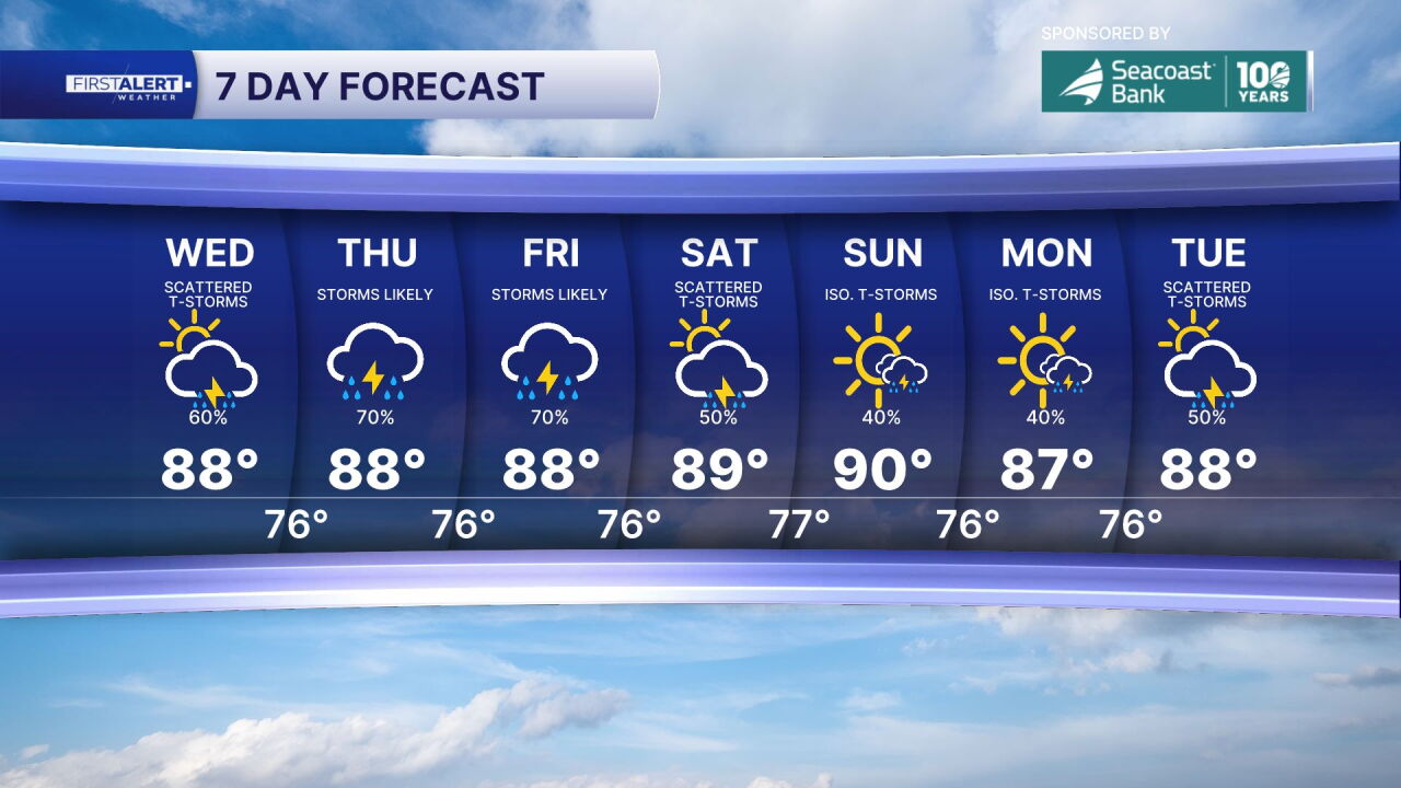
Despite the increasingly wet conditions, temperatures will remain relatively stable rather than surging to dangerous levels. High temperatures should generally stay in the upper 80s to around 90 degrees, with very warm and humid conditions dominating the overall feel. The increasing cloud cover and frequent rainfall will actually serve as a natural cooling mechanism, preventing temperatures from reaching the excessively hot levels that might otherwise develop during clear, sunny conditions.
MORE WEATHER: Radar | Alerts | 7-Day Forecast | Hourly Forecast
*Portions of this story were assisted by artificial intelligence tools and reviewed by a WPTV journalist to ensure accuracy, clarity, and adherence to editorial standards.


