

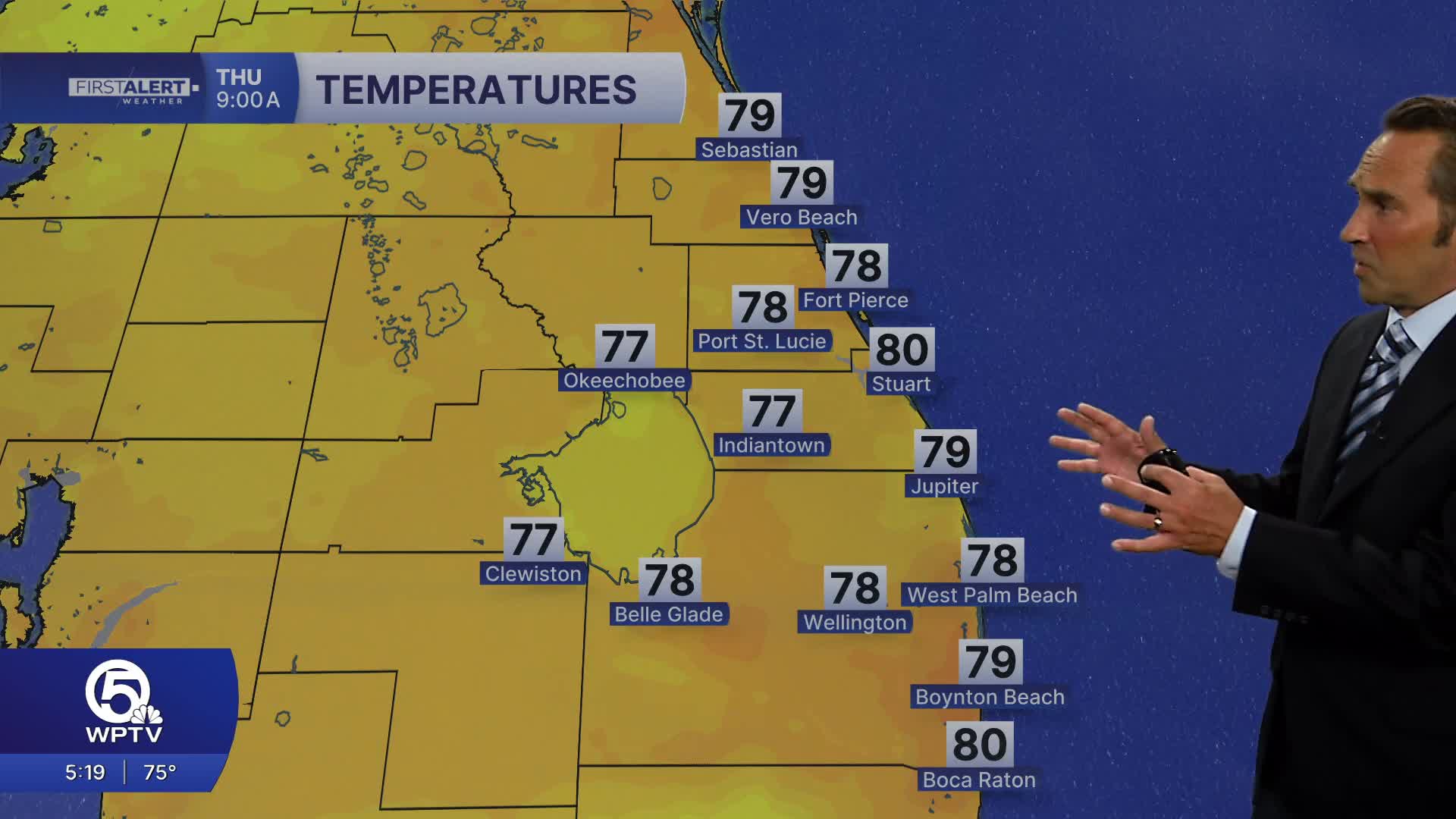


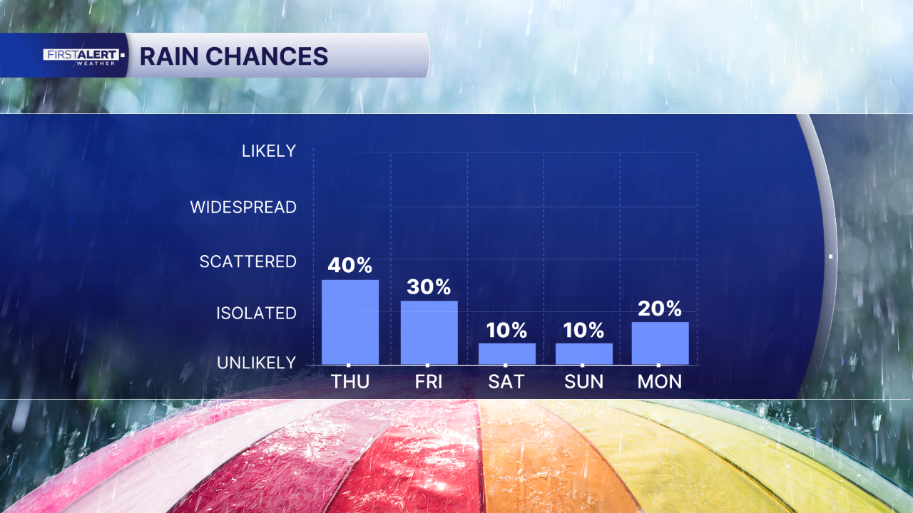
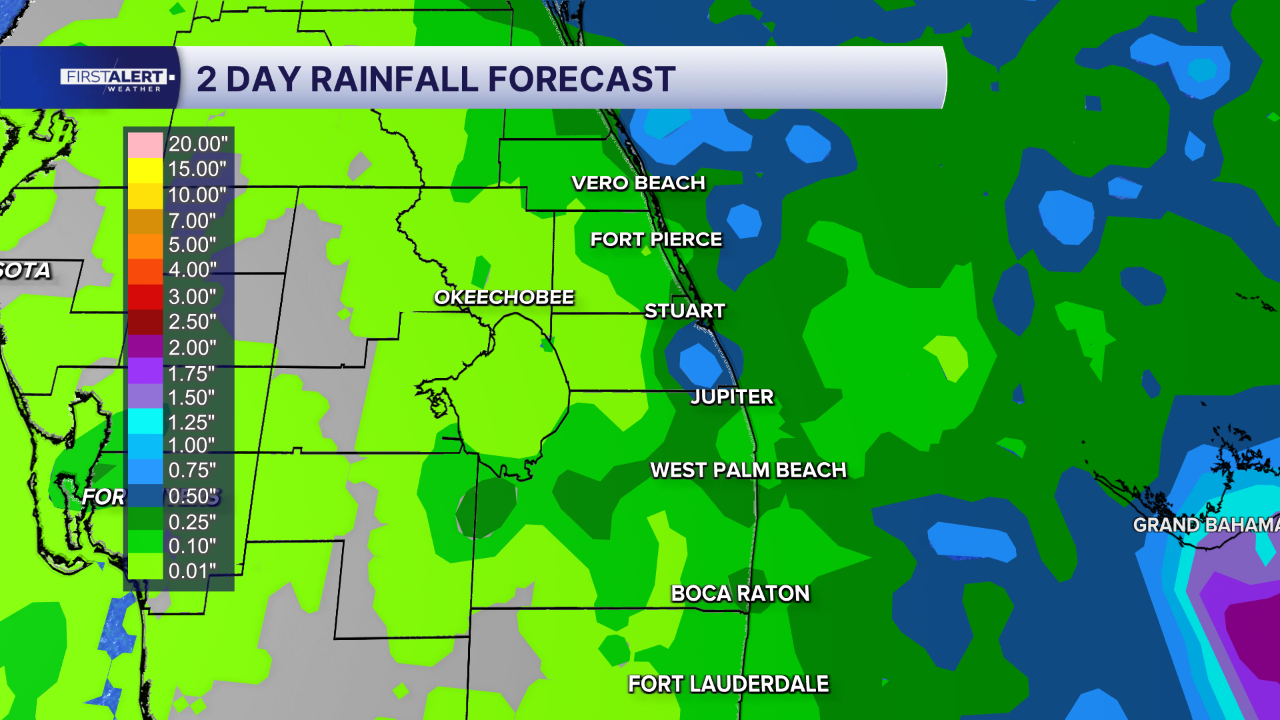
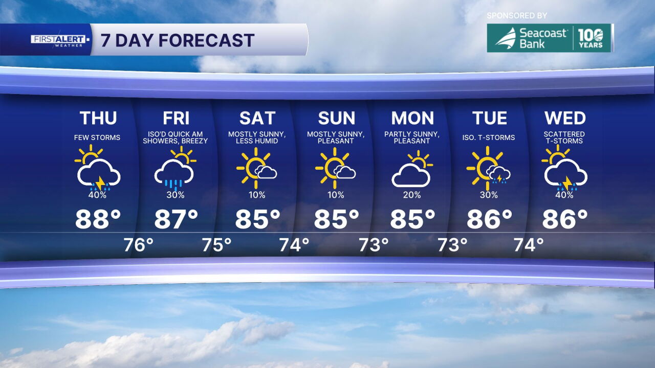
WEST PALM BEACH, Fla. — A shift toward drier conditions is taking hold across the Treasure Coast and Palm Beaches as we head into the weekend, with rain chances declining significantly and widespread heavy downpours becoming increasingly unlikely. While isolated afternoon showers or thunderstorms remain possible, the overall pattern favors more stable weather with plenty of heat and humidity maintaining temperatures in the upper 80s throughout the period.
A high-risk rip current situation is developing that demands serious attention from anyone planning coastal activities. Northerly winds combined with increasing swell are pushing substantial energy toward the shoreline, creating conditions that the National Weather Service has classified as high risk for rip currents beginning late tonight and continuing through the weekend. Palm Beach County beaches face particularly hazardous conditions, with large breaking waves potentially reaching 7 to 8 feet that will create powerful, life-threatening currents capable of pulling even strong swimmers offshore.
The timing coincides with this weekend's Harvest full moon and King Tide cycle, which will produce higher-than-normal tides and create additional concerns for minor coastal flooding in vulnerable low-lying areas. This astronomical combination amplifies the already dangerous surf conditions and increases the potential for water to reach areas that typically remain dry during normal tide cycles.
Swimming should only occur near lifeguarded beaches with careful attention to posted warning flags, as rip currents remain invisible threats that can quickly overcome unsuspecting beachgoers regardless of their swimming ability or ocean experience.
MORE WEATHER: Radar | Alerts | 7-Day Forecast | Hourly Forecast
*Portions of this story were assisted by artificial intelligence tools and reviewed by a WPTV journalist to ensure accuracy, clarity, and adherence to editorial standards.


