


WEST PALM BEACH, Fla. — A strong high-pressure system keeps pleasant, yet gusty weather conditions around through Friday, especially along the coast.
Choppy marine conditions continue over the Atlantic waters and Lake Okeechobee. Beachgoers should be cautious too—there’s still a high risk of rip currents along all Atlantic beaches, making swimming potentially dangerous.
MORE WEATHER: Radar | Alerts | 7-Day Forecast | Hourly Forecast
The good news? Winds will gradually ease as we head toward the end of the workweek.
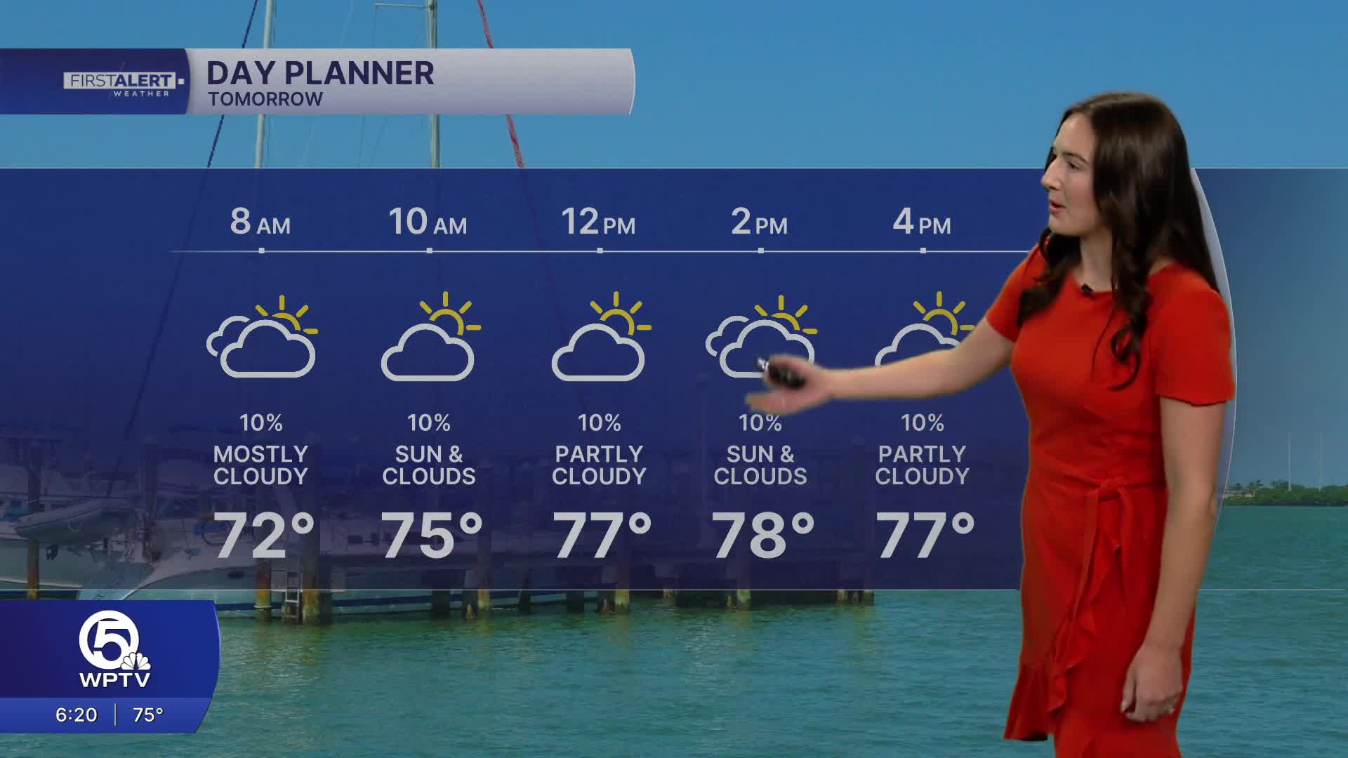
A little moisture may sneak in over the next couple of days, thanks to a weak disturbance developing over the southeastern U.S. and drifting into the Gulf. Still, rain chances remain low—only about a 10-20% chance of a quick shower each day, and rainfall totals are expected to stay light.
Temperatures will be comfortable through the rest of the work week, ranging fro the upper 70s-lower 80s.
Looking ahead to the weekend, conditions stay fairly typical for South Florida. A weak front passing to the north will shift winds more southerly, bringing a slight uptick in afternoon showers and thunderstorms—mainly inland and across northern areas over the weekend. Otherwise, it will be partly sunny and warm.
Winds will relax even more, possibly becoming light or calm at times, especially by Sunday. Humidity will be rising though with temperatures following suit.
By early next week, drier weather may return, but temperatures will start climbing, with highs reaching the upper 80s to low 90s across much of the region.
**Portions of this story were assisted by artificial intelligence tools and reviewed by a WPTV journalist to ensure accuracy, clarity, and adherence to editorial standards.


