


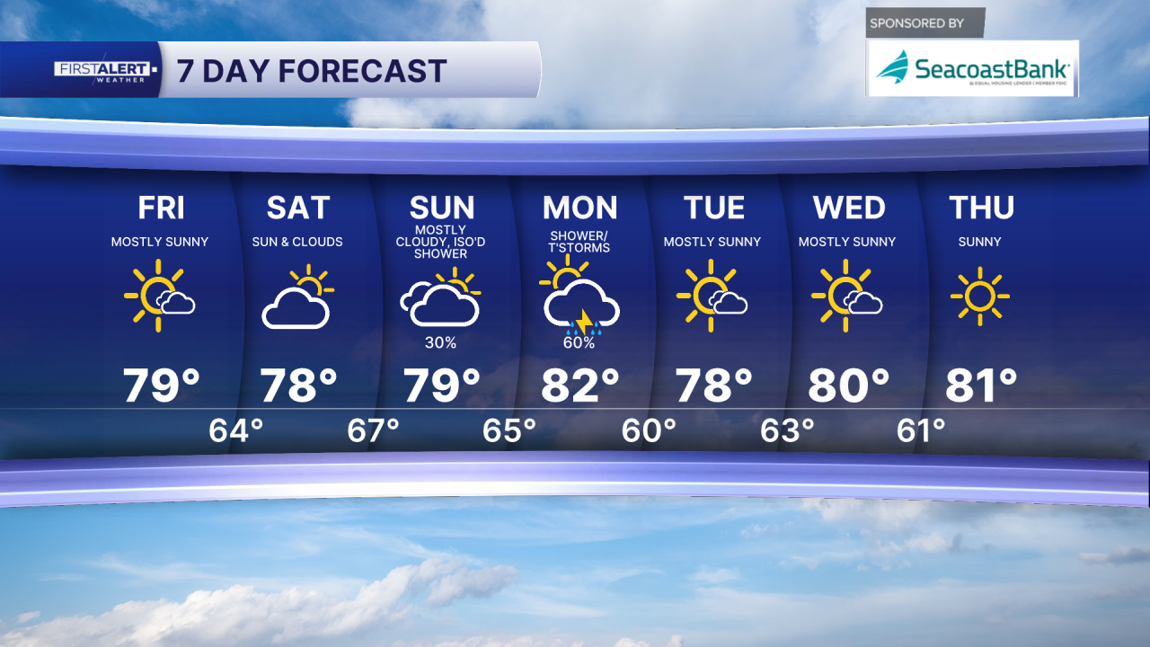
WEST PALM BEACH, Fla. — South Florida’s stretch of quiet, pleasant weather is sticking around through the end of the week.
Afternoon highs today will climb into the upper 70s and low 80s, while mornings stay comfortably cool — mid-50s inland and low 60s along the East Coast metro areas. Winds will stay light, shifting from northerly to more easterly as high pressure builds along the Eastern Seaboard.
Overall, it’s a great setup for outdoor plans on Friday and Saturday, with only a very slim chance of a stray shower.
The short-term weather concern is fog. Patchy to dense fog developed early this morning across inland and Southwest Florida, prompting a Dense Fog Advisory for Collier County and possibly nearby areas.
Visibility may also drop around sunrise in parts of the East Coast metro. If you’re commuting, take it slow and leave extra space between vehicles. Conditions should gradually improve after the morning hours as the weak boundary currently draped across central Florida fades away.

Looking ahead to late weekend into early next week, we have some changes coming. A stronger system developing over the eastern United States will drag a cold front across the Florida Peninsula sometime late Sunday into Monday.
While there’s still some disagreement in the exact timing, confidence is growing that scattered showers/thunderstorms — and possibly periods of light to moderate rain — will move through during that time. Once the front clears, high pressure builds back in, returning South Florida to more seasonable, dry conditions for the rest of next week.
MORE WEATHER: Radar | Alerts | 7-Day Forecast | Hourly Forecast
**Portions of this story were assisted by artificial intelligence tools and reviewed by a WPTV journalist to ensure accuracy, clarity, and adherence to editorial standards.


