


WEST PALM BEACH, Fla. — We're heading into several days of unsettled weather, with periods of heavy rain, gusty winds and dangerous beach conditions.
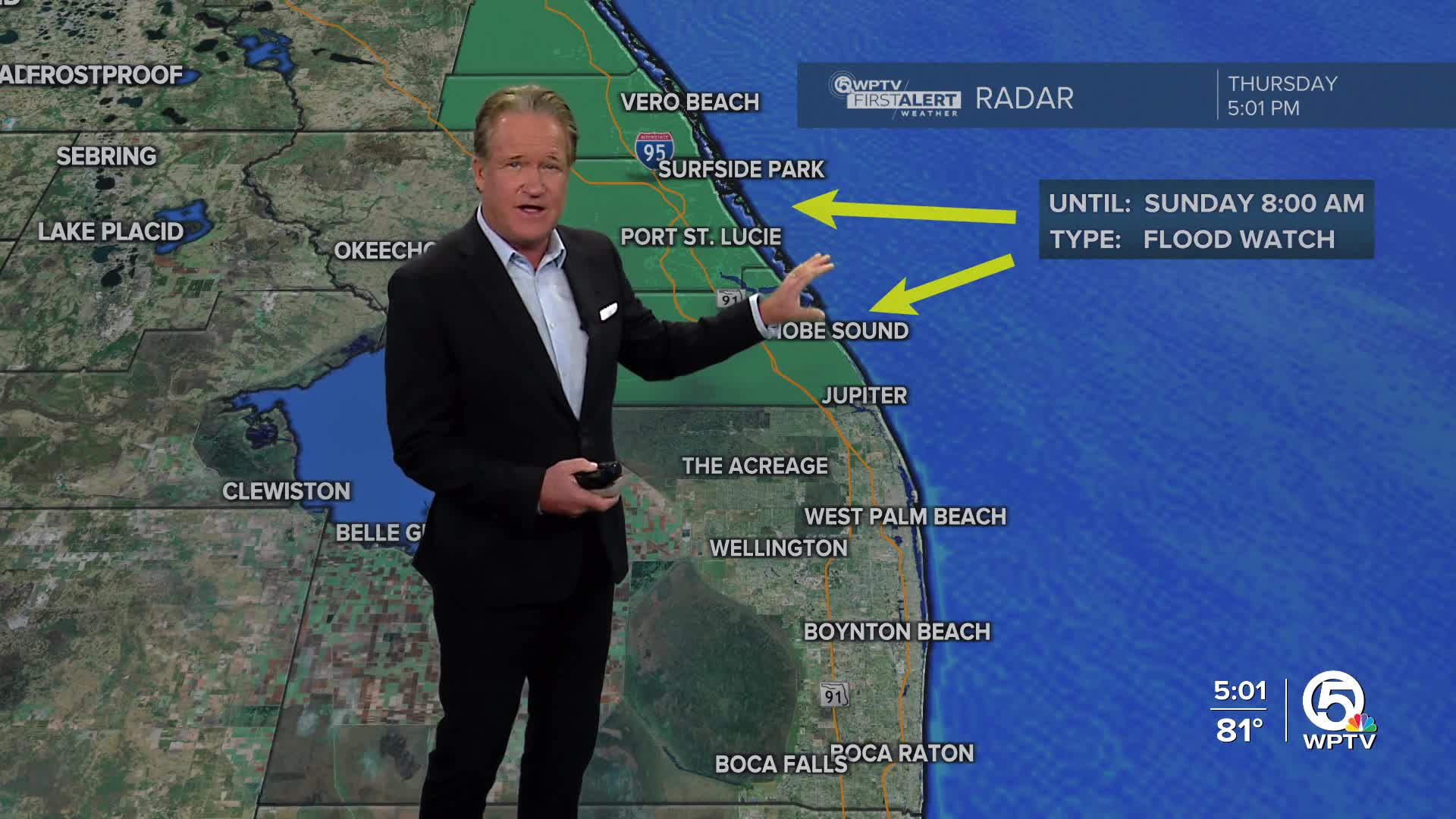
A flood watch is in effect for Indian River, Martin and St. Lucie counties through Sunday at 8 a.m.
MORE WEATHER: Radar | Alerts | 7-Day Forecast | Hourly Forecast
Over the next few days, we're looking at a soggy and breezy stretch of weather. Moist air from the Atlantic is streaming in, and that means off-and-on showers, storms, and the potential for heavy rainfall, especially near the coast.
Some places — mainly along the Treasure Coast and Space Coast — could see localized flooding through the weekend, so keep an eye out for any alerts or flood advisories.
Coastal Concerns
If you're heading to the beach or out on the water, be extra cautious. Conditions will remain dangerous through the weekend with strong rip currents, rough surf with waves 5- 8 feet high and some beach erosion, especially around high tide cycles.
These aren't your typical beach days—stay out of the water if you're not an experienced surfer, and keep small boats in port if you can.

What's Causing This?
A large area of high pressure to our north is pushing in air from the northeast, causing breezy to gusty winds (15–25 mph or higher near the coast) and helping to pull in all that moisture from the ocean. Add in a weak weather disturbance sitting offshore, and you've got the perfect setup for steady rain and some storms.
Rain could come down fast at times, especially along the coast, where 1–3 inches are likely, with some spots getting over 4 inches. Even Orlando and the surrounding inland areas could get in on the action as these showers move inland.

Temperatures
Expect warm, muggy nights in the mid to upper 70s and daytime highs in the low to mid 80s—so not much of a temperature swing, especially near the coast.
Watching a Possible Low Near the Bahamas
Some weather models are hinting at a weak low-pressure system forming near the northwest Bahamas Friday night, possibly moving across South Florida on Saturday. The National Hurricane Center is keeping an eye on it too, though they’re only giving it a low chance (10%) of developing into anything tropical.
Even if it doesn’t become a tropical system, any low that forms could still increase rainfall—especially for areas along Florida's east-central coast.
Looking Ahead
By Sunday, the really deep tropical moisture is expected to start shifting north, and winds should calm down a bit, though they'll still be coming in from the ocean. Rain chances will gradually go down next week, but we’ll likely still see scattered showers—about a 50/50 shot most days. If the drier trend continues, we might be able to lower rain chances even more by midweek.
Temperatures should stay near normal for this time of year, with highs in the mid to upper 80s.


