


Weather Summary
A cold front will push across the "Sunshine State" Thursday night. Out ahead of it, a few passing showers are possible Wednesday and Thursday. Most areas will stay dry, but if you have outdoor plans you may briefly need the umbrella. That same front may return in the form of a warm front during the second half of the weekend. Therefore, we'll squeak out one more really nice day on Sunday, but the rains will likely return with the passage of this front Sunday night and Monday.
The water will once again be a little rough for the beach goers. The high rip current risk will continue through Wednesday night. Please make sure you're only swimming on guarded beaches.
MORE WEATHER: Radar | Alerts | 7-Day Forecast | Hourly Forecast
7 Day Forecast
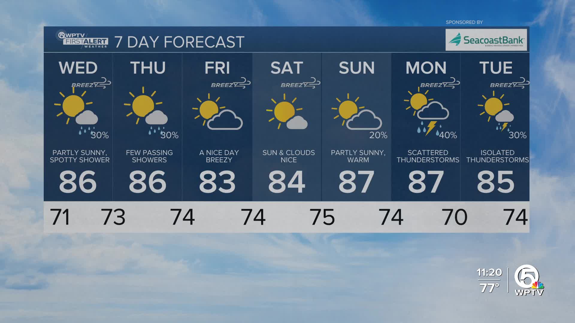
Wednesday: Sun and clouds. A spotty shower is possible. High 86.
Thursday: Sun and clouds. A spotty shower is possible. High 86.
Friday: Mostly sunny, breezy and nice. High 83.
Saturday: Mostly sunny and breezy. High 84.
Sunday: Partly sunny, warmer. A late day shower or thunderstorm is possible. High 87.
Monday: Showers and thunderstorms likely. High 87.
Tuesday: Partly sunny with a spotty shower. High 85.
*Portions of this story were assisted by artificial intelligence tools and reviewed by a WPTV journalist to ensure accuracy, clarity, and adherence to editorial standards.


