

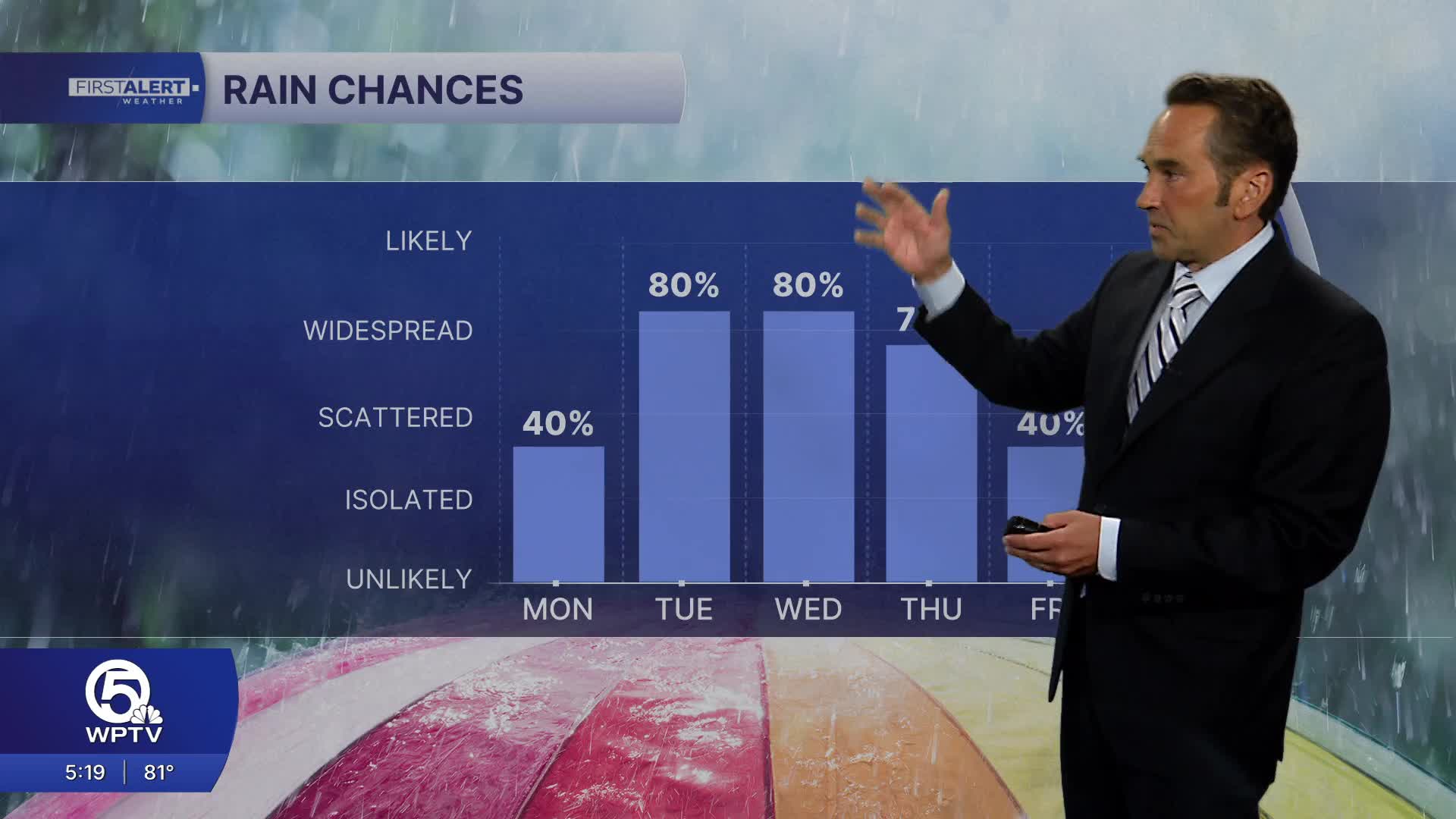


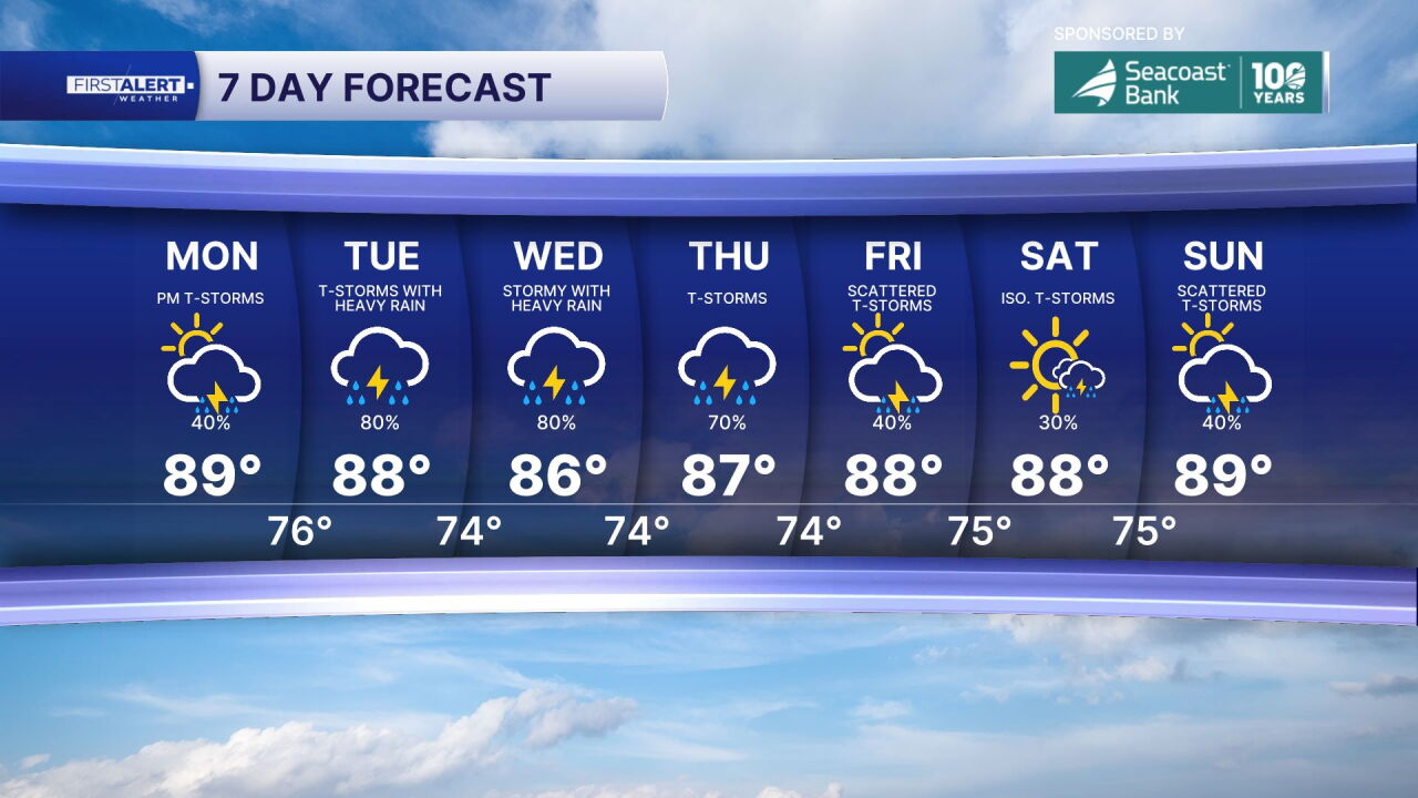
WEST PALM BEACH, Fla. — Today starts relatively dry, especially compared to what's ahead later this week. Expect plenty of sunshine this morning, with only a few isolated coastal showers. As temperatures climb into the upper 80s this afternoon, a few thunderstorms will develop, but overall Monday looks like one of the better days of the week for outdoor plans.
That changes Tuesday as moisture increases across South Florida. Scattered showers and thunderstorms become more widespread, with some storms capable of producing very heavy downpours. The atmosphere will take on a much more tropical feel as humidity and moisture levels continue to build.
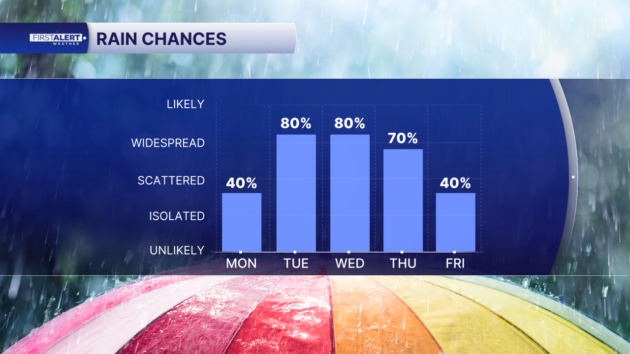
By Wednesday, the setup looks most favorable for widespread rain. A cold front will be settling into Florida while deep tropical moisture pools along it, creating the potential for periods of heavy rain and numerous thunderstorms. Some locations could see significant rainfall totals and localized flooding, especially where storms repeatedly move over the same areas.
The weather remains unsettled Thursday and Friday. While rainfall may become a bit more scattered and variable, don't expect a return to dry conditions just yet. The National Weather Service continues to forecast above-normal rain chances across the region through the end of the workweek.
So what's driving all of this? A cold front is pushing south toward Florida, but this isn't the type of front that delivers a crisp autumn cooldown. Instead, the front is expected to stall across the peninsula, acting more as a focus for clouds, showers and thunderstorms than a source of cooler air.
MORE WEATHER: Radar | Alerts | 7-Day Forecast | Hourly Forecast


