

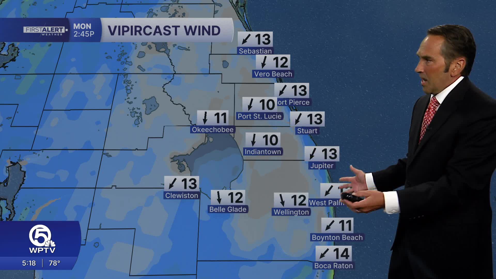


WEST PALM BEACH, Fla. — A drier, less humid air mass is beginning to settle into the Treasure Coast and Palm Beaches, bringing some relief from the recent stretch of heat and muggy conditions. While temperatures will remain seasonably warm, the air should start to feel noticeably more comfortable, especially overnight and into Tuesday morning.
Expect a mix of clouds and sunshine Monday, with highs in the upper 80s. A few afternoon showers or thunderstorms are still possible, but rain chances will be lower than they were over the weekend. Skies should begin to clear by evening, setting up a quieter end to the day.
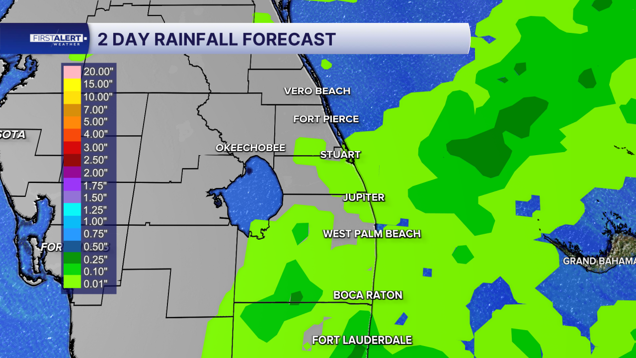
Tonight, drier air will continue filtering into the region, allowing temperatures to fall into the upper 60s and lower 70s. Humidity levels will drop, making for a more comfortable night.
The bigger change arrives Tuesday and Wednesday as high pressure builds in. More sunshine, fewer showers and lower humidity are expected across the Treasure Coast and Palm Beaches. Afternoon highs will generally reach the mid to upper 80s, while mornings will feel noticeably more comfortable with less of the usual tropical stickiness.
Enjoy the break from the recent wet weather pattern. Rain chances should remain minimal through midweek, though moisture may gradually return later in the week, bringing a few isolated showers back to the forecast.
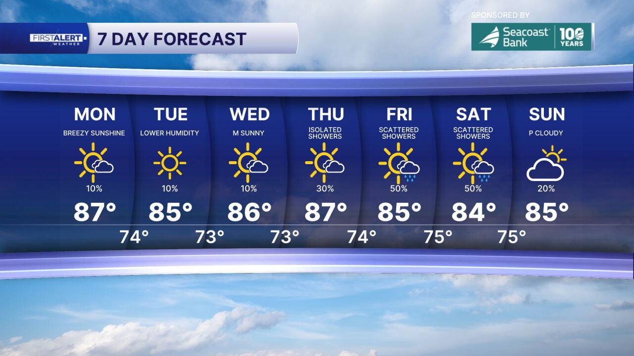
The bottom line: A welcome taste of more comfortable October weather is on the way. Expect lower humidity, fewer storms and pleasant evenings, while afternoons remain typically warm across the Treasure Coast and Palm Beaches.
MORE WEATHER: Radar | Alerts | 7-Day Forecast | Hourly Forecast
Portions of this story were assisted by artificial intelligence tools and reviewed by WPTV journalists to ensure accuracy, clarity and adherence to editorial standards.


