
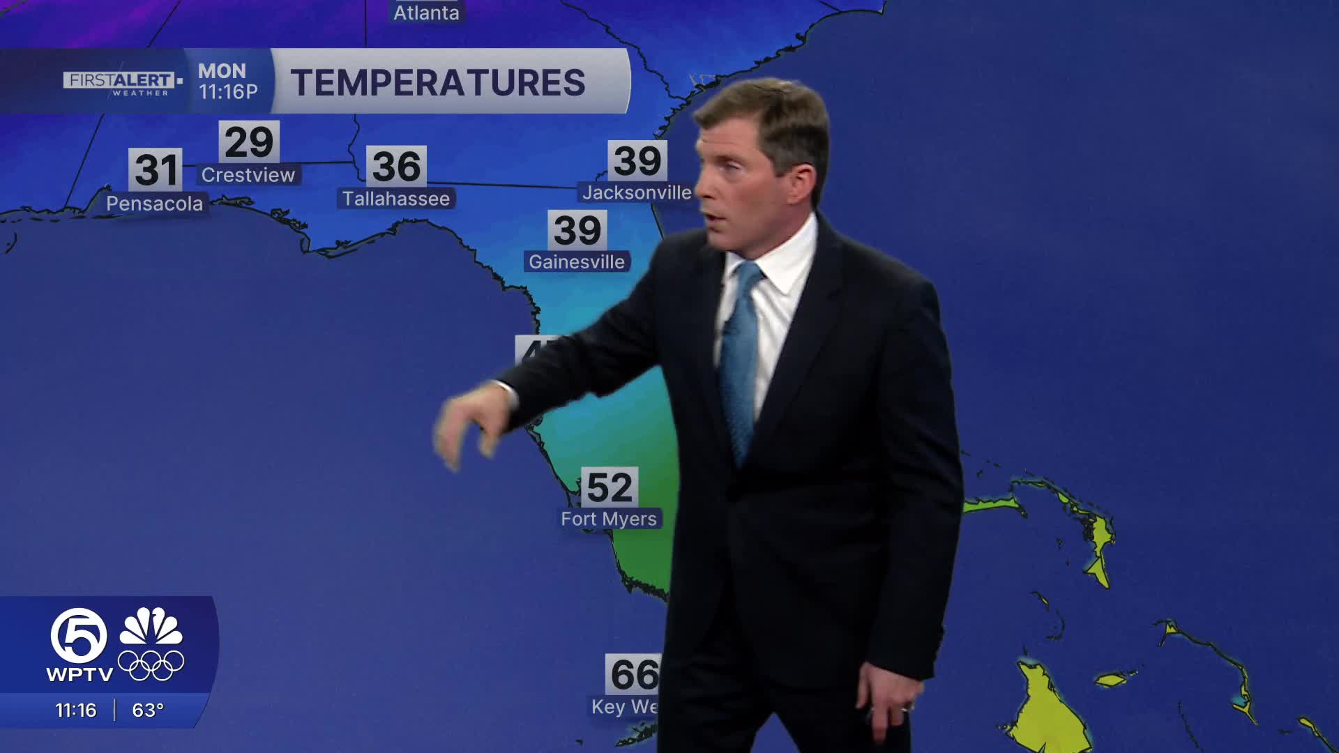


WEST PALM BEACH, Fla. — A strong cold front is causing temps to tumble through Tuesday morning.
These cooler temps will stick around through the extended forecast.
MORE WEATHER: Radar | Alerts | 7-Day Forecast | Hourly Forecast
We could see wind chills drop into the upper 30s to mid 40s, with the coldest being in Okeechobee County. Even coastal metro areas will wake up to a much colder Tuesday morning and afternoon with highs only getting into the 60s.
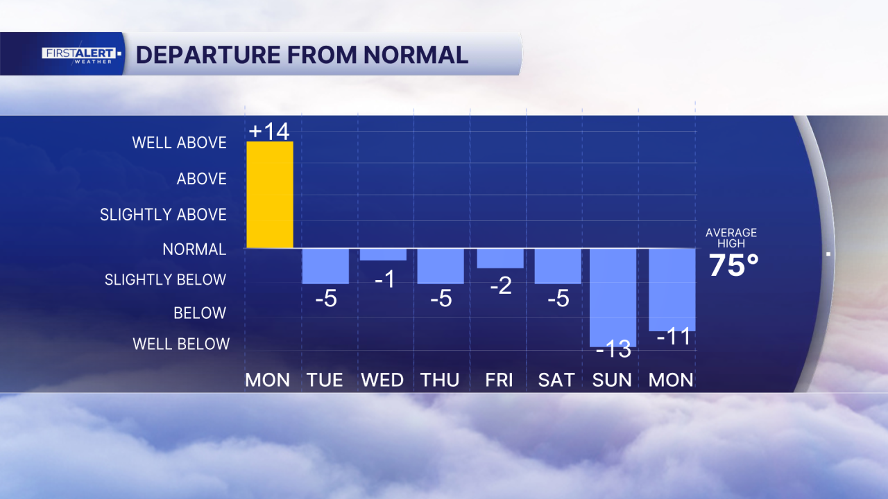
A series of fronts will keep temperatures below average through at least the weekend and early next week.
The front will also make things rough on the water and along the beaches. A Gale warning is in effect through early Tuesday morning and a Small Craft Advisory through Wednesday as winds ramp up and seas build behind the front, with hazardous marine conditions likely lasting several days. Gusty, dry air behind the front may also elevate fire danger at times this week.
**Portions of this story were assisted by artificial intelligence tools and reviewed by a WPTV journalist to ensure accuracy, clarity, and adherence to editorial standards.


