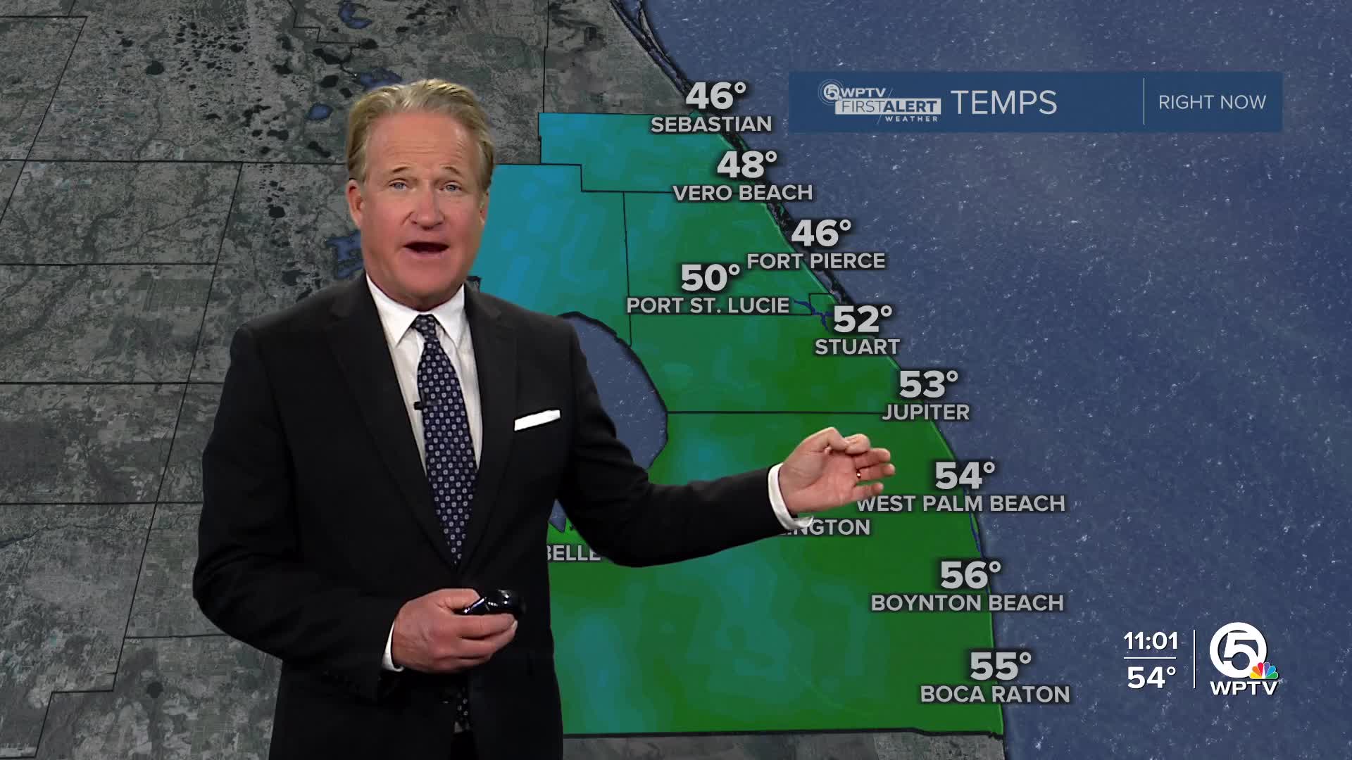
Weather

Actions

FORECAST: Cold temperatures, heavy gusts create increased fire risk

WPTV First Alert Weather Forecast for Morning of Tuesday. Nov. 11, 2025
Weather thumbnail Nov. 11, 2025
Posted
and last updated

A cold weather advisory is in effect for all counties in our viewing area until 9 a.m. Tuesday. Wind chill values in the 30s can lead to hypothermia with prolonged exposure.

A Red Flag Warning is in effect for Okeechobee County from 10 a.m. to 4 p.m. Tuesday. A breezy northwest wind will cause any fires that develop to spread quickly. Outdoor burning is not recommended.

WPTV First Alert Weather Forecast for Morning of Tuesday. Nov. 11, 2025

South Florida is waking up to some of the coldest air we’ve seen since February, and it’s not just the chill you’ll feel when you step outside. The combination of dry air, gusty winds, and cold temperatures is creating multiple weather hazards across the region.

The Storm Prediction Center has highlighted parts of southwest Florida under an elevated to moderate Fire Weather Risk, prompting a Red Flag Warning in parts of Florida today. The dry and breezy setup is creating dangerous fire weather conditions in southwest Florida.

Red Flag Warning Nov. 11, 2025

Strong northerly winds are also keeping the surf high and seas rough along both coasts.

A High Surf Advisory is in effect for the Palm Beaches, with breaking waves of 6 to 9 feet and a high Rip Current Risk continuing through Wednesday morning.

A Small Craft Advisory is in effect along the entire east coast and Lake Okeechobee due to rough waters. Seas will range from 7 to 12 feet.

Highs will struggle to reach 70 degrees along the east coast on Tuesday, and areas around Lake Okeechobee may not even make it out of the 50s. These temperatures are near record lows for daytime highs in early November.

Cold Weather Advisory, Nov. 11, 2025

Overnight lows will fall into the low 40s near the Lake and 50s to around 60 along the coast. That will keep the mornings feeling brisk through midweek before a gradual warming trend returns by Wednesday afternoon.

By midweek, highs will rebound into the mid-70s with plenty of sunshine, but it will still feel cooler than normal for this time of year.

High pressure will settle over the region by Wednesday and stick around into the weekend, bringing a stretch of dry weather and slowly moderating temperatures. Highs will return to the upper 70s and low 80s by the weekend with no rain in the forecast.

7-day forecast Nov. 11, 2025

After a frigid start to the week, Florida sunshine will bring back a little warmth just in time for the weekend.

MORE WEATHER: Radar | Alerts | 7-Day Forecast | Hourly Forecast