



WEST PALM BEACH, Fla. — A cold front is arriving this weekend, bringing widespread showers, thunderstorms, and gusty winds that will create dangerous conditions along the coast.
Spotty coastal showers are possible this morning. In the afternoon, showers and thunderstorms will shift inland, while a mix of sun and clouds is expected near the coast. Temperatures will reach the mid to upper 80s today with slightly cooler air arriving later this weekend.
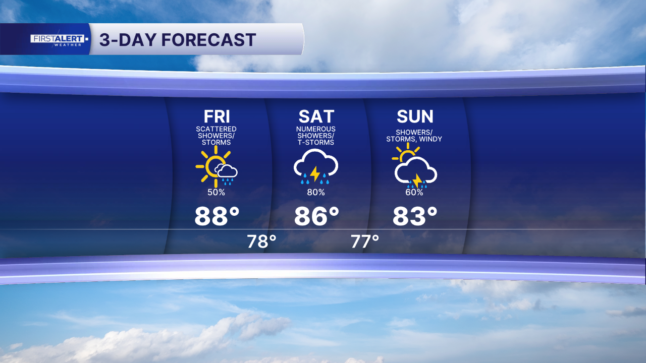
While a couple of passing showers are possible Saturday morning, the storms are not expected to arrive until the afternoon. Widespread showers and thunderstorms are anticipated to form Saturday. Depending on rain rates and storm training, flooding due to excessive rainfall is much more possible Saturday.
Scattered rain showers and storms will linger into Sunday. Highs will only reach the lower 80s.
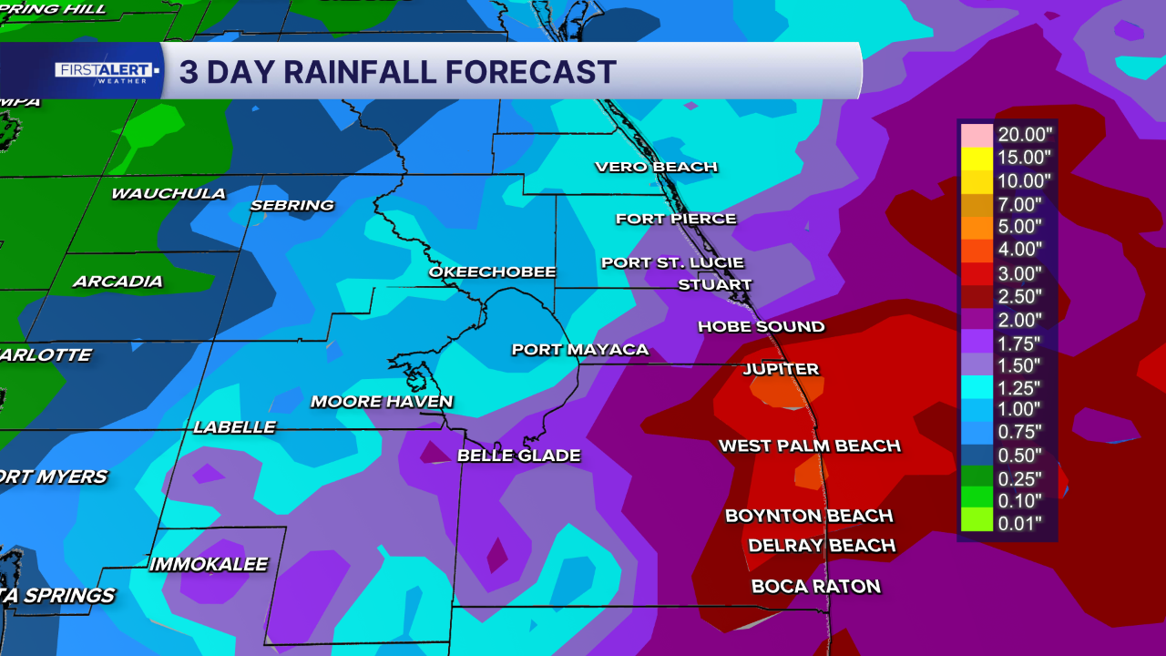
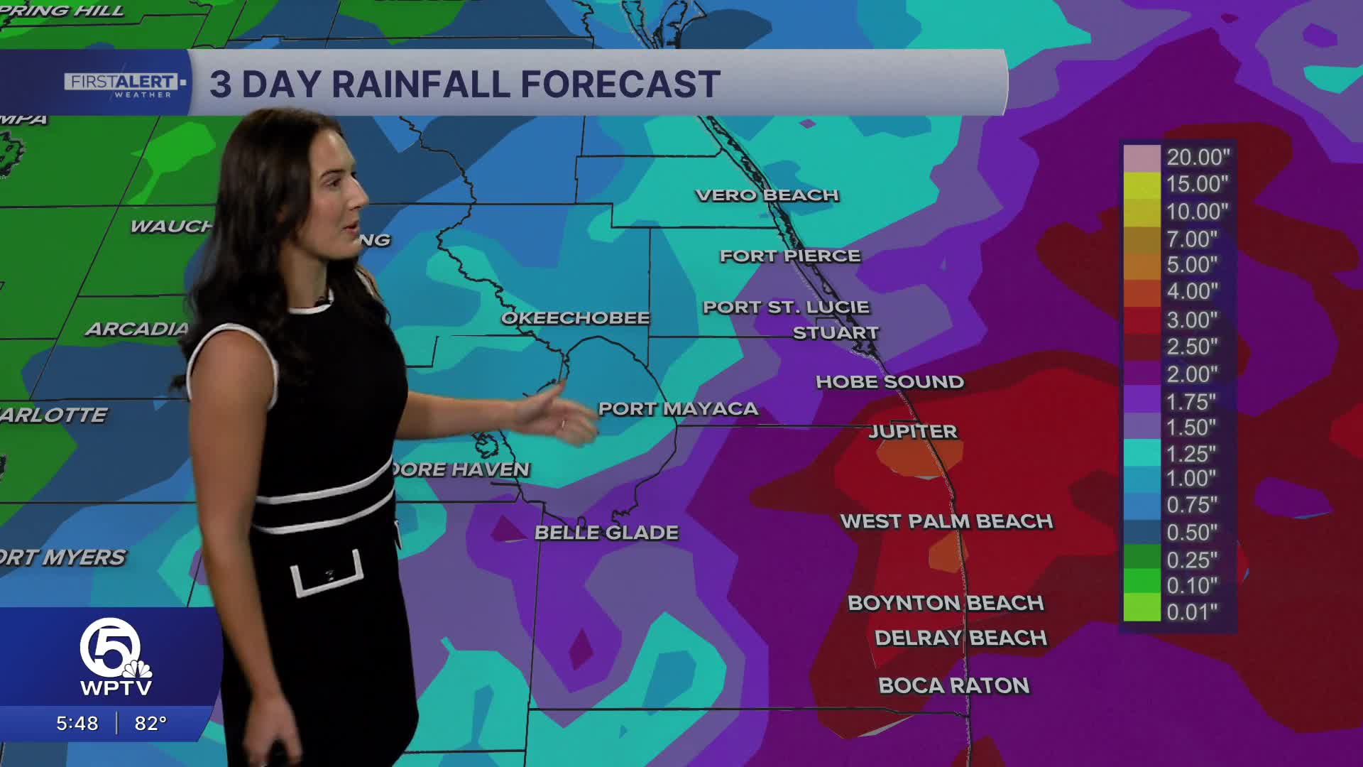
Between 3 and 5 inches of rain is possible this weekend, especially along the coast. The Weather Prediction Center currently has a Marginal Risk issued for excessive rainfall that could lead to isolated flash flooding.
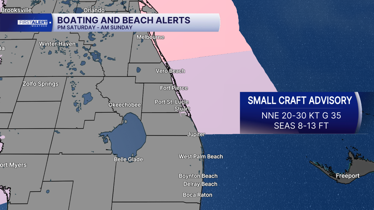
Gusty winds up to 35 mph behind the front are expected to create dangerous boating conditions, high surf, and moderate beach erosion this weekend and into next week. Residents and visitors should use caution near the beach and remain out of the water beginning this weekend.
MORE WEATHER: Radar | Alerts | 7-Day Forecast | Hourly Forecast
Portions of this story were assisted by artificial intelligence tools and reviewed by a WPTV meteorologist to ensure accuracy, clarity, and adherence to editorial standards.


