
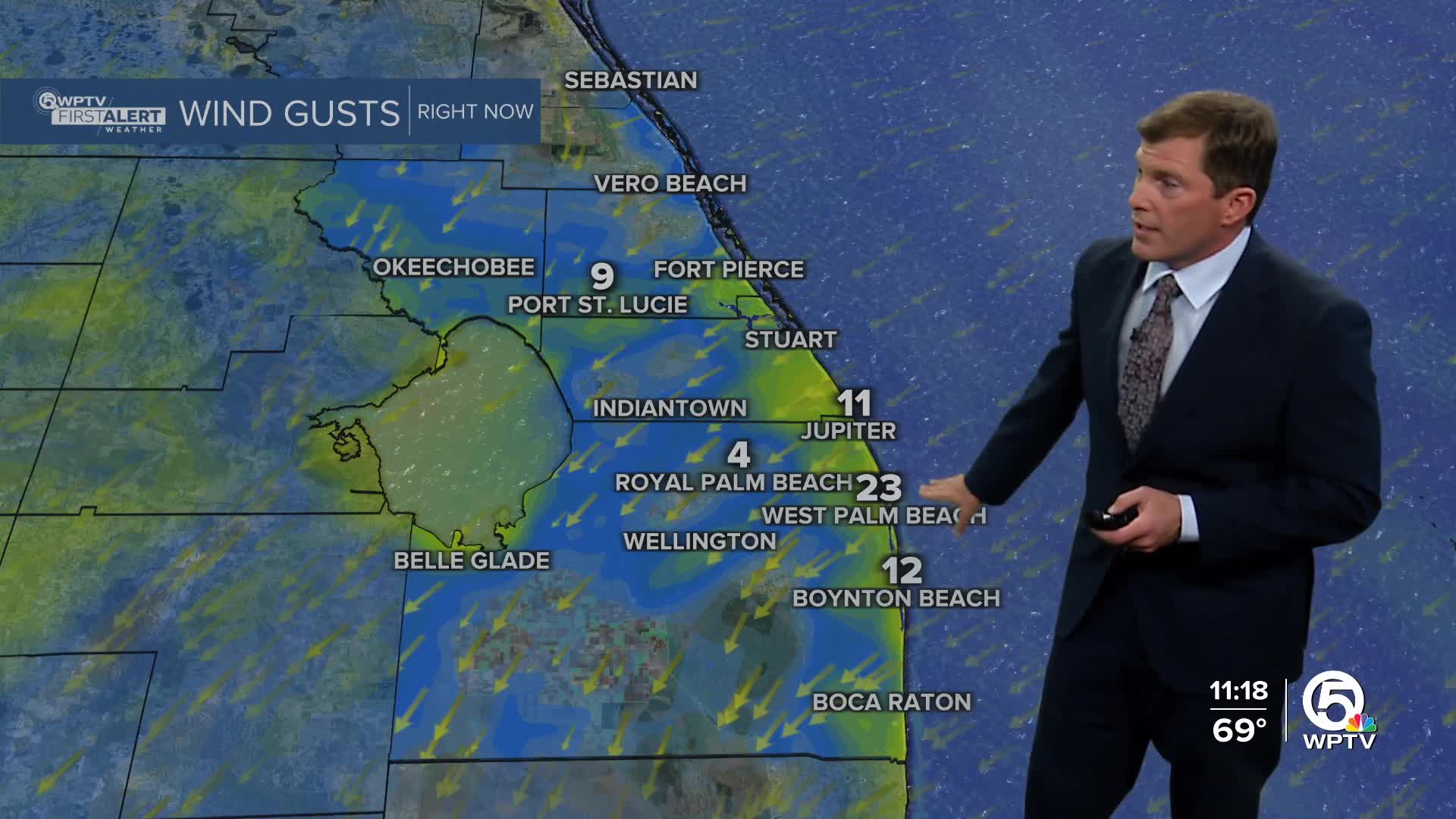


WEST PALM BEACH, Fla. — Strong winds and cooler air continues across South Florida tonight as an Arctic air mass pushes across the southeast. Gusty northerly winds will be strongest along the Atlantic coast, where a wind advisory is in effect through evening. Coastal gusts could reach up to 30 mph at times.
Clouds skies will gradually start to clear overnight. A few brief coastal showers are possible through this evening. Rain chances drop significantly Tuesday as much drier air moves in.
As high pressure settles in and winds veer NE - we'll see a slow warm-up on Tuesday afternoon with high temps in the mid 70s.
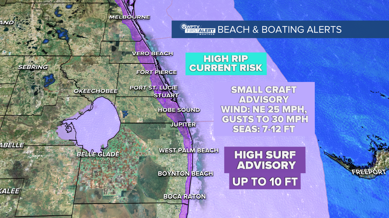
Marine and beach conditions will be hazardous through mid-week. Small Craft Advisories are in effect for all local waters due to strong winds and rough seas. Along the Atlantic beaches, a high risk of rip currents continues, and a High Surf Advisory is in place through early Tuesday for Palm Beach and Broward counties, where waves could reach 10 feet or higher.
Looking ahead, weather conditions improve later this week with dry, pleasant weather. Temps will warm to above average for this time of year - returning to the 80s by late week.
MORE WEATHER: Radar | Alerts | 7-Day Forecast | Hourly Forecast


