


WEATHER SUMMARY
The pattern is about to become very active again over the next few days with downpours and thunderstorms. This in large part thanks to an upper level feature that will be moving over the peninsula. Some of the computer guidance shows between 3 and 5 inches of rain by Sunday afternoon with isolated heavier amounts. Some flooding is possible, especially if we begin to see training (thunderstorms and downpours moving over the same areas over and over). There will be dry stretches as well where the sun will peak through the clouds, but overall it looks very unsettled.
BEACH AND BOATING
Dangerous marine conditions will continue through the weekend including a High Surf Advisory and Small Craft Advisory. Inexperienced mariners, especially those operating small vessels, should avoid the water over the next few days. For beach goers, red flags are still flying on local beaches. There's a very high risk of rip currents out there. If you decide to go into the water make sure it's on a guarded beach only.
7 DAY FORECAST
Tonight: Partly cloudy with a spotty shower. Heavier downpours are possible towards daybreak. Low 75.
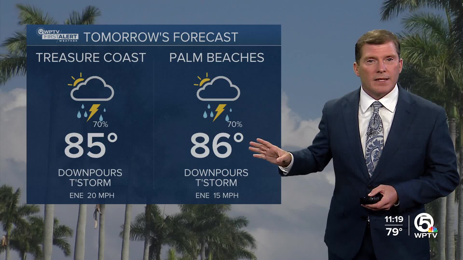
Thursday: Mostly cloudy with scattered downpours and thunderstorms likely. High 86.
Friday: Clouds, some sun. Scattered downpours and thunderstorms likely. High 85.
Saturday: Sun and clouds. Scattered downpours and thunderstorms likely. High 85.
Sunday: Sun and clouds. Scattered showers and thunderstorms likely. High 86.
Monday: Mostly sunny. An afternoon shower or thunderstorm is possible. High 86.
Tuesday: Mostly sunny, warm and humid. A spotty thunderstorm is possible. High 86.
Wednesday: Mostly sunny, warm and humid. A spotty shower is possible. High 86.
MORE WEATHER: Radar | Alerts | 7-Day Forecast | Hourly Forecast


