


WEST PALM BEACH, Fla. — South Florida and the Treasure Coast will experience a mostly dry and breezy stretch of weather through midweek, accompanied by comfortable temperatures and ample sunshine.
Today will be breezy, especially along the Atlantic coast, but winds will gradually ease by tonight and into Wednesday.
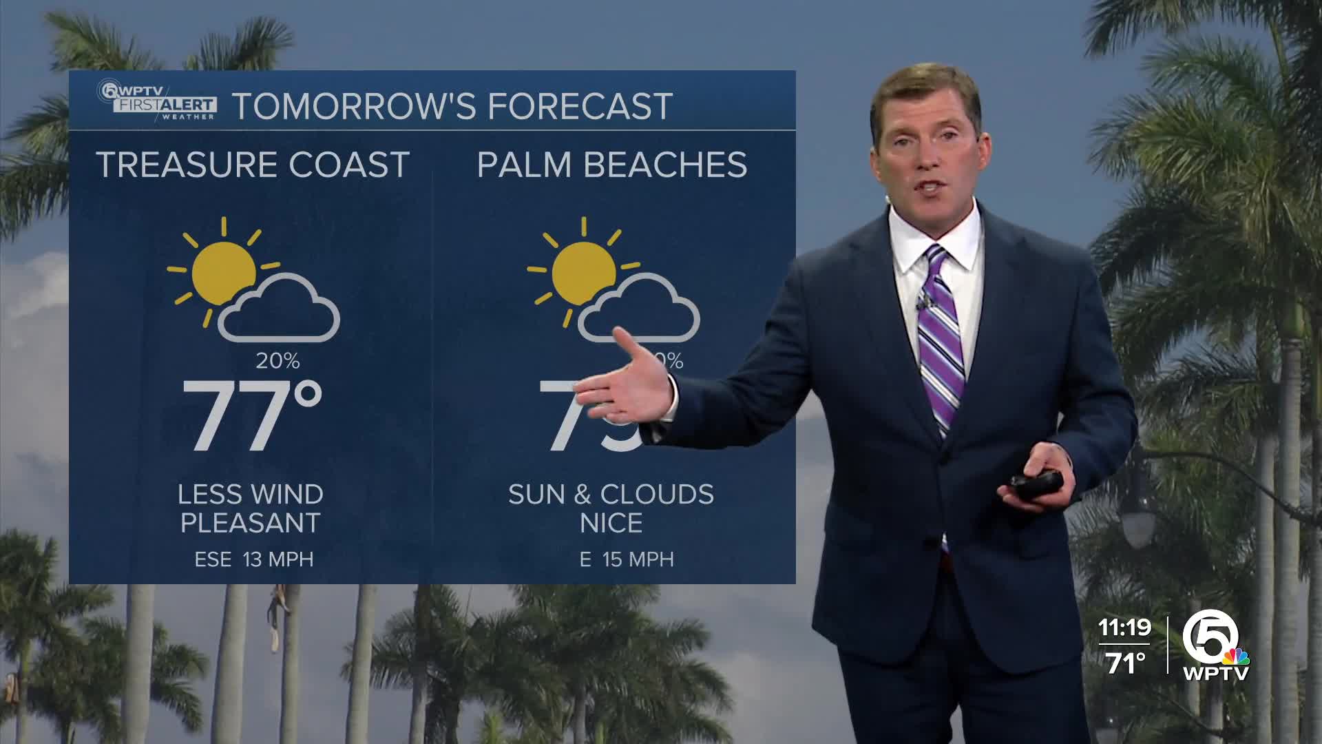
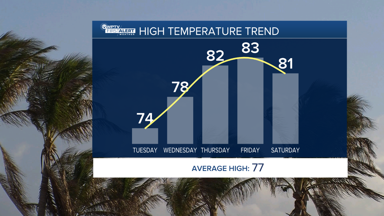
Highs today will reach the mid-to-upper 70s, with cooler overnight lows in the mid-50s inland and mid-to-upper 60s along the coast.
Wednesday will be slightly warmer, with highs in the upper 70s to lower 80s.
Rain chances remain very low through Wednesday, though a brief, passing shower is possible for the Palm Beaches. By Thursday, even warmer and more humid air returns as winds shift from the south ahead of a weakening cold front.
A few scattered showers may develop late Thursday into Friday, but thunderstorm chances are minimal. Temperatures late week will be warm, ranging from the lower 80s near the coast to the mid-80s inland.
The weekend looks mostly dry as high pressure rebuilds. Afternoon temperatures will remain in the lower 80s near the coast and mid-80s inland.
Marine and beach hazards continue despite the calm weather on land. Choppy conditions on the Atlantic waters persist today, with seas up to 6 to 9 feet before improving midweek. A high risk of rip currents remains in effect along Atlantic beaches through Thursday.
MORE WEATHER: Radar | Alerts | 7-Day Forecast | Hourly Forecast


