

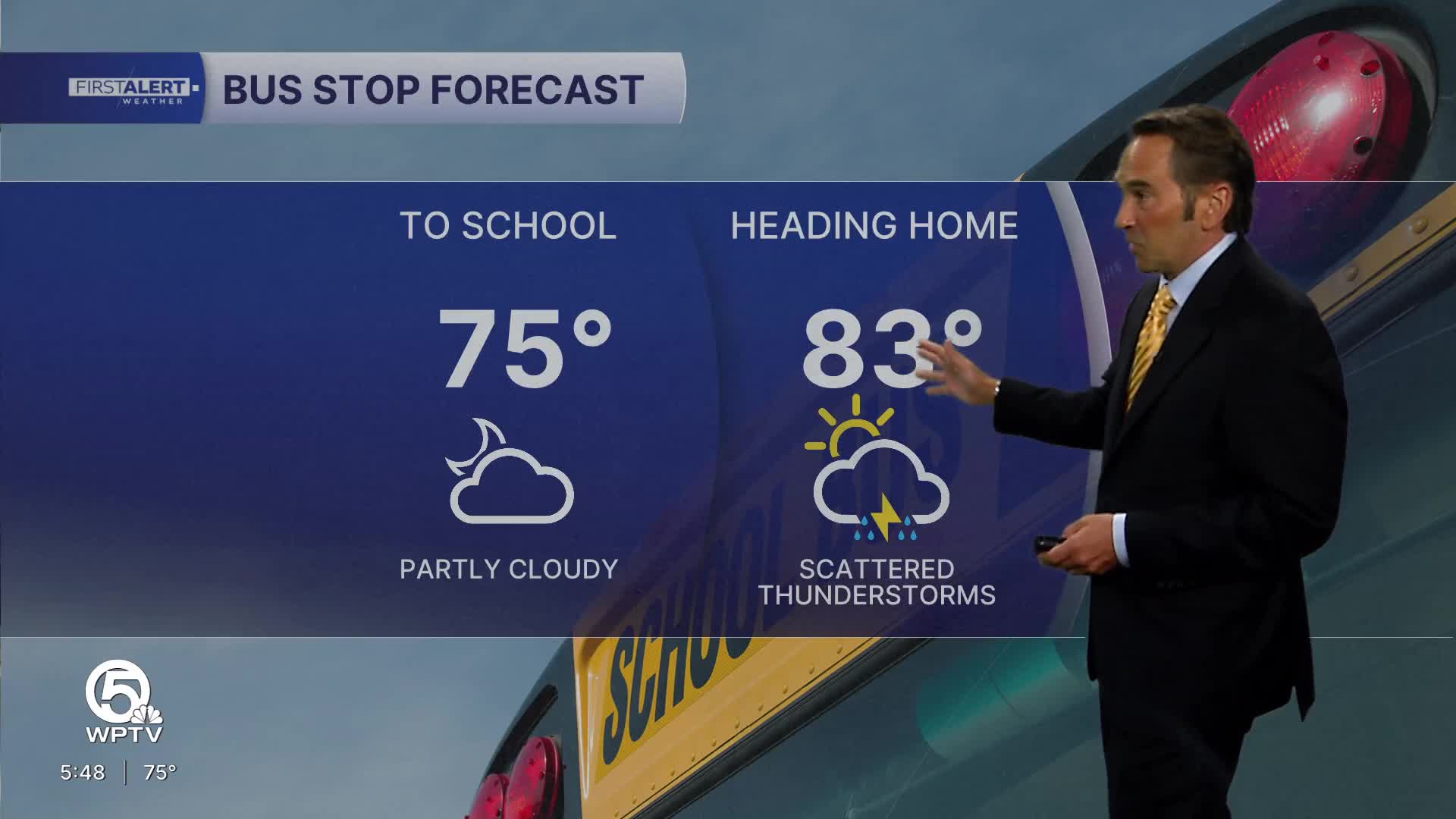


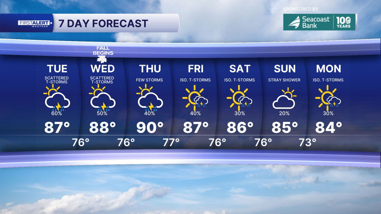
WEST PALM BEACH, Fla. — Today, the last day of summer, features mostly sunny to partly sunny skies with hot, humid temperatures reaching 88-89°F. Scattered afternoon thunderstorms will provide some relief from the heat, with overnight lows settling into the comfortable mid-70s range.
Tomorrow marks a significant shift toward more active weather patterns, with Wednesday bringing increasingly unsettled conditions as showers and thunderstorms become likely throughout the afternoon and evening hours. Thursday continues this stormy trend with another active rain day, as storm chances peak during late morning and extend well into the afternoon, though temperatures remain steady near 88°F for both days.
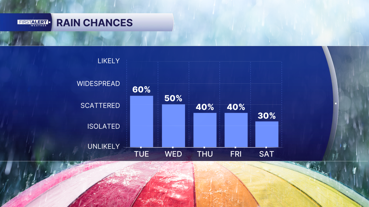
By Friday, conditions begin showing signs of improvement despite a lingering 50% chance of showers and storms across the Treasure Coast. Temperatures drop slightly to around 87°F while northeast winds strengthen to 10-15 mph, signaling the approaching pattern change that will dominate the weekend.
The weekend through Monday offers a welcome return to more typical weather across the region, with generally sunnier skies and significantly lower rain chances compared to the midweek period. However, afternoon and evening showers and thunderstorms remain possible as heat and humidity persist. Treasure Coast areas will see temperatures trending toward 86°F, while Palm Beach County maintains readings in the mid-to-upper 80s.
MORE WEATHER: Radar | Alerts | 7-Day Forecast | Hourly Forecast
**Portions of this story were assisted by artificial intelligence tools and reviewed by a WPTV journalist to ensure accuracy, clarity, and adherence to editorial standards.


