

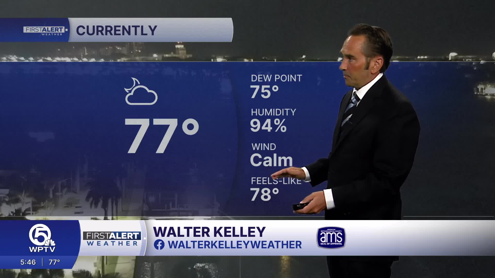


WEST PALM BEACH, Fla. — A stormy afternoon pattern is settling in today. Expect a warm, humid start with a mix of sunshine and clouds before showers and thunderstorms become more widespread later in the day.
Some storms could be strong, bringing torrential rain, frequent lightning, gusty winds and intense downpours. Areas that see repeated rounds of rain could experience localized street flooding.
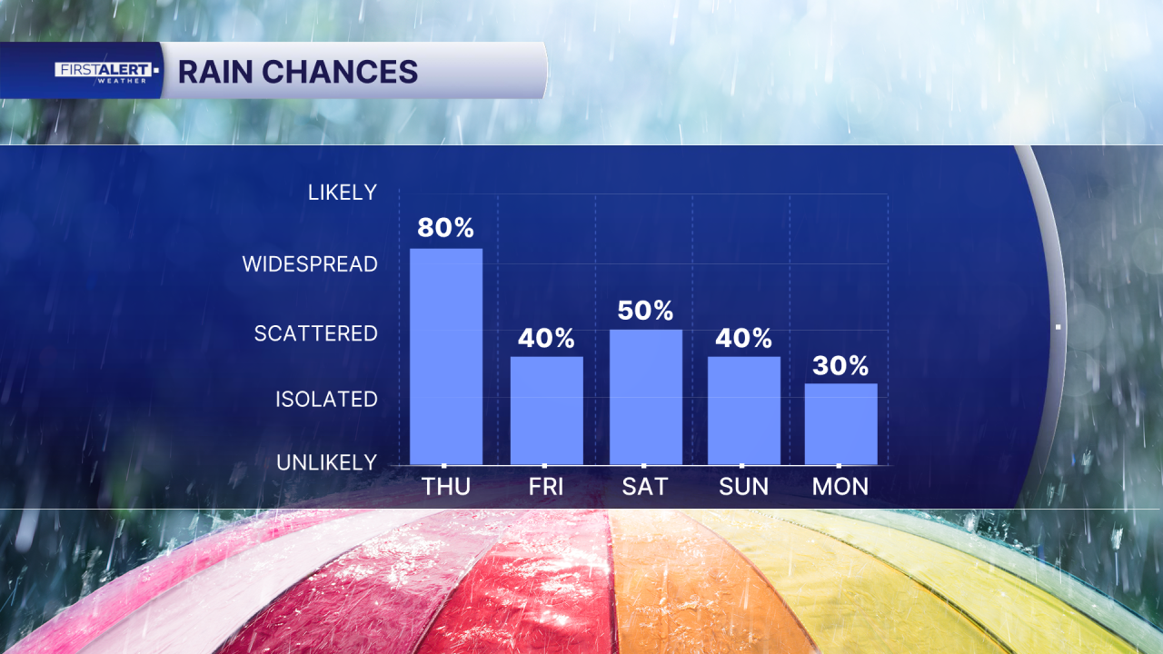
Palm Beaches: High temperatures will reach the mid to upper 80s. Storms will become more likely this afternoon and evening, with heavy rainfall possible in some locations. If you have outdoor plans, be prepared for changing weather later in the day.
Treasure Coast: Similar conditions are expected, with scattered to numerous afternoon thunderstorms. Martin and St. Lucie counties could see particularly heavy downpours and brief strong wind gusts.
Beach Safety: If you're heading to the beach, plan to get out of the water early. Lightning will be the biggest hazard as storms develop during the afternoon. Remember: If you hear thunder, move indoors immediately.
Rip current concerns are also increasing as an Atlantic swell builds. The National Weather Service says the Palm Beaches could reach a high rip current risk as conditions worsen. Swim near a lifeguard, pay attention to beach warning flags, and never try to swim directly against a rip current. Instead, float and swim parallel to shore until you're out of the current.
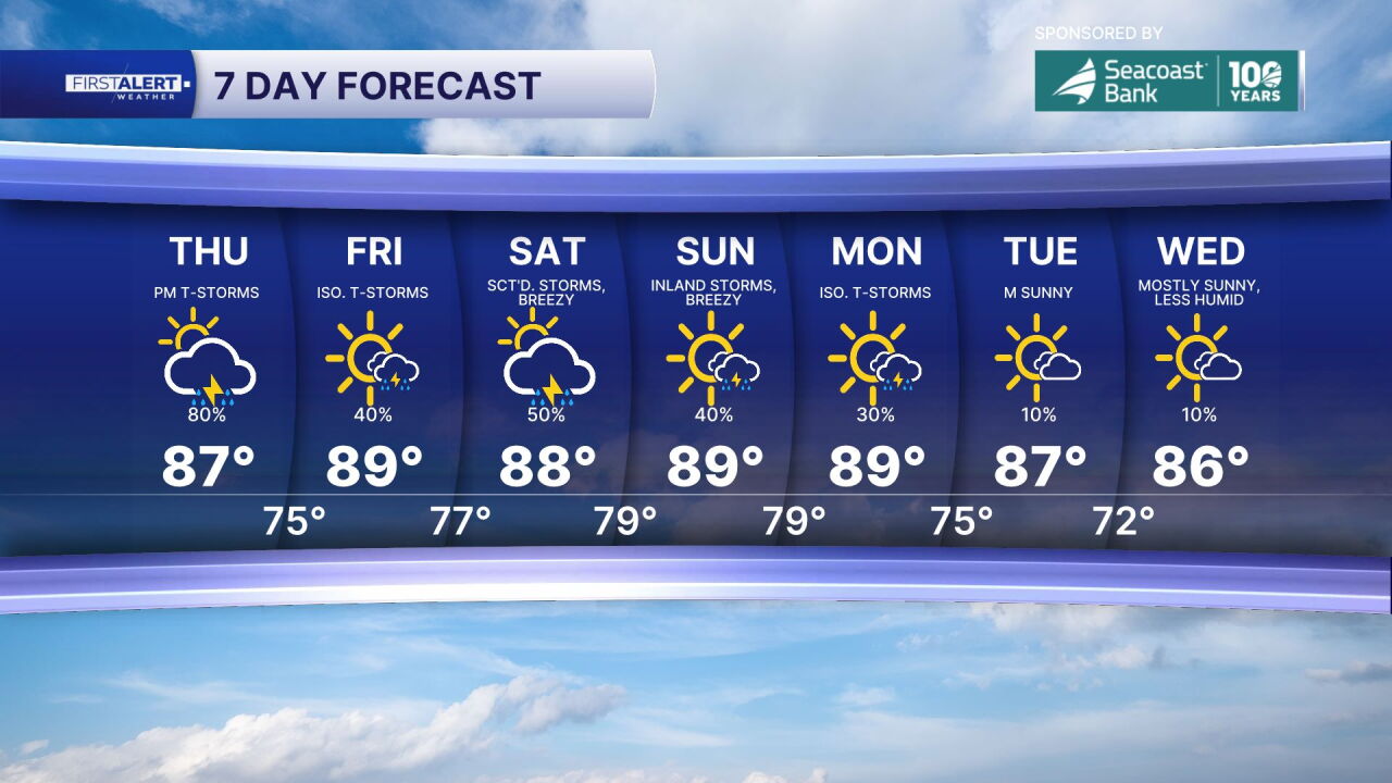
Weekend Outlook: Unsettled weather continues Friday, with afternoon and evening storms becoming more likely. Saturday will bring another round of showers and thunderstorms, along with breezy coastal winds that could gust between 20 and 25 mph. Conditions should improve Sunday, with more sunshine returning, although a few showers and storms remain possible.
MORE WEATHER: Radar | Alerts | 7-Day Forecast | Hourly Forecast


