


WEST PALM BEACH, Fla. — South Florida is heating up this week as high pressure settles over the state, bringing above-normal temperatures and mostly dry conditions through early Thursday.
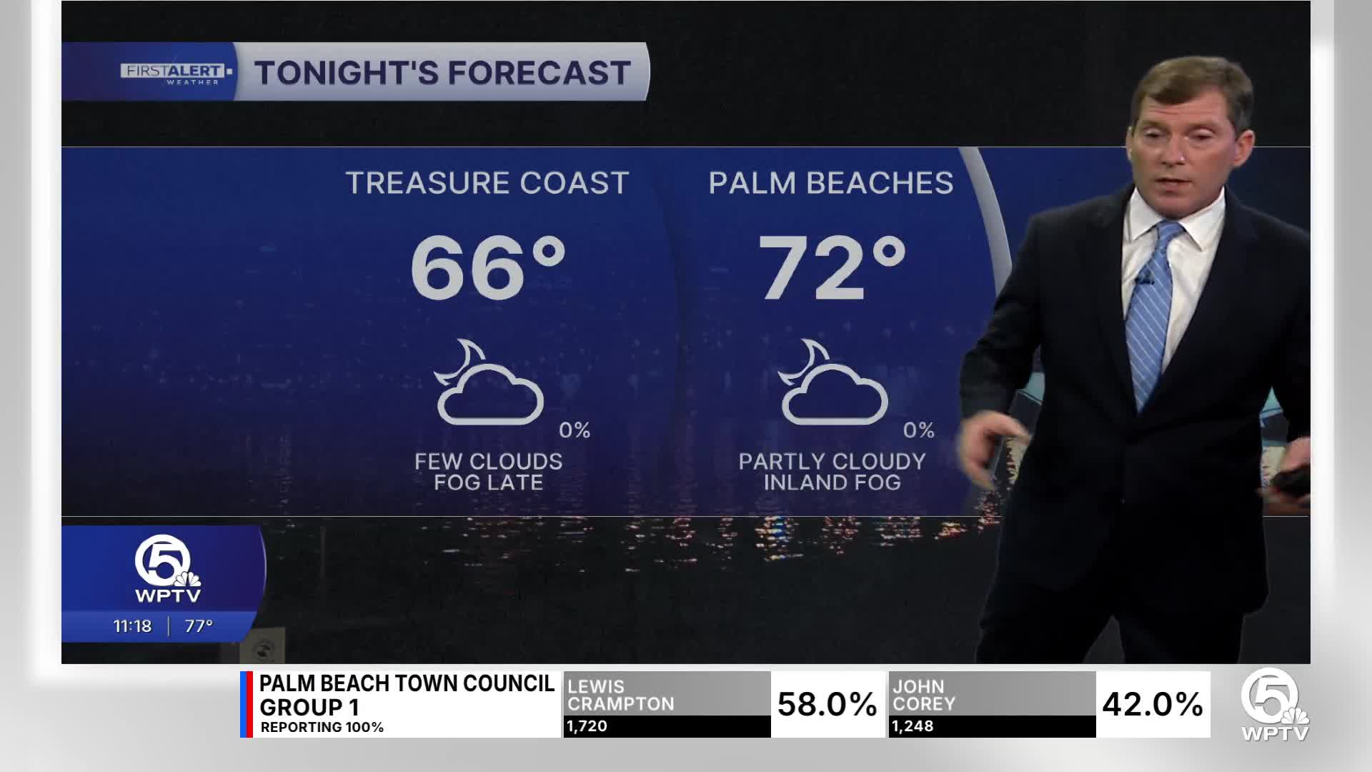
Patchy fog will once again develop overnight through the morning. Visibility may be low in low-lying areas that are prone to fog. Overnight lows settle into the mid- to upper-60s inland and low 70s.
Mainly sunny and dry air will dominate the forecast for Wednesday. Afternoon highs will climb into the mid-upper 80s. Coastal areas will stay a bit cooler in the mid-80s thanks to the sea breeze.
By Thursday, things begin to change as a cold front approaches from the north. Temperatures will remain very warm ahead of the front, with many areas still reaching the upper 80s on Thursday. Rain chances increase during the late afternoon and evening, with scattered showers and thunderstorms developing as the front moves through the region Thursday night.
The more unsettled pattern sticks around into the weekend and early next week.

MORE WEATHER: Radar | Alerts | 7-Day Forecast | Hourly Forecast
Lingering moisture keepS periodic showers and thunderstorms in the forecast Friday through Monday as another cold front arrives. Some storms could bring gusty winds, small hail, and heavy downpours.
Behind that next front, drier air and cooler temperatures are expected by next Tuesday, bringing highs down into the low-mid 70s.
Meanwhile, boaters should be aware that winds and seas will begin increasing late this week, leading to rougher marine conditions.
**Portions of this story were assisted by artificial intelligence tools and reviewed by a WPTV journalist to ensure accuracy, clarity, and adherence to editorial standards.


