


WEST PALM BEACH, Fla. — After several humid days, a refreshing change is settling into South Florida. A push of drier air behind a departing storm system off the Carolinas will bring lower humidity, plenty of sunshine, and comfortable conditions to wrap up the weekend and start the new week.
Winds will drive in from the north, to northwest today. Due to a northerly swell, we will have dangerous marine conditions. Coastal flood advisory is in effect for our entire coastline. In addition to that, we have a high rip current risk and a small craft advisory. Seas will be near 5 to 8 ft, so please be cautious on the waters.
The cold front has swept south of us, which will lead to a spectacular day outside! We will be under mainly sunny skies with dry air moving into South Florida.
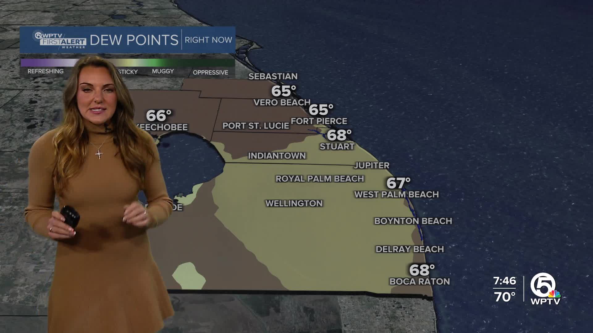
Humidity levels will drop noticeably, especially across the interior, with dew points dipping into the 60s. Afternoon highs will stay seasonable with highs in the lower to middle 80s. The northerly flow this afternoon
MORE WEATHER: Radar | Alerts | 7-Day Forecast | Hourly Forecast
As we head into this week, the Florida Fall-like weather will continue to linger. It will be even more beautiful and comfortable on Monday! Lower humidity and a nice chill early Monday morning with temperatures in the middle 60s. Highs on Monday will be in the lower 80s.
Winds will begin to pick up on Tuesday from the northeast and it will be breezy with wind speeds near 15 mph. A coastal isolated shower can't be ruled out, but it will be mainly dry and sunny. Rough surf and marine conditions will persist. Highs will stay seasonal near the lower to middle 80s.
As we head toward mid to late week, winds will turn more northeasterly and eventually easterly, allowing some moisture to return. That could bring a few quick, isolated coastal showers by Thursday or Friday, but widespread rain is not expected. Highs will remain near 90 inland, with lows holding steady in the upper 60s and low 70s.


