
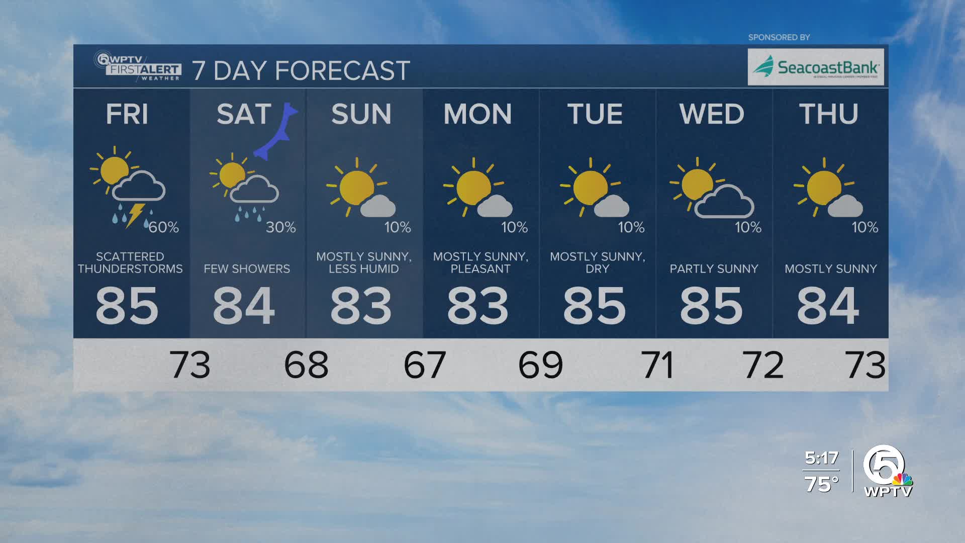


WEST PALM BEACH, Fla. — As an area of low pressure starts to pull away from South Florida on Saturday, our rain chances will dramatically decrease
We can't rule out some passing showers on Saturday, but the activity will be much less widespread than the last few days.
As the ground is very saturated following this past week's rain - localized flooding will be possible where rain does occur.
We are looking to our first taste of fall this weekend. A cold front will push south on Saturday, a few showers possible with that, then starting this Sunday, drier air is expected to flow into South Florida, which may stick around for much of the following week.
You'll notice much more comfortable humidity levels. This front is the start of our transition out of rainy season and into the drier month of November.
MORE WEATHER: Radar | Alerts | 7-Day Forecast | Hourly Forecast
During this transition, it’s worth noting that moderate coastal flooding could occur during high tide this weekend, and rip current risk will be up over the weekend as a new swell fills in so beachgoers should exercise caution.
Enjoy the drier air this weekend along with more sunshine too!


