
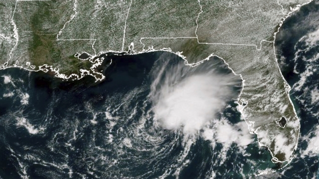


Hurricane season is still more than three months away, but as scientists look ahead to June, the official start of the 2024 Tropical Atlantic season, forecasters at NOAA say they are seeing increasing signs of a major pattern flip.
The current strong El Niño conditions taking hold in the northern hemisphere are bringing heavy snow as far south as Mississippi this winter and historic atmospheric river storms to the West Coast. But a La Niña pattern that could be in full swing at the peak of the Atlantic Basin season could trigger an extremely active few months of tropical activity.
The switch to La Niña historically signals a more active hurricane season.
However, what has some experts, like weather and climate specialist Dr. Marshall Shepherd, concerned are the historically warm waters in the Atlantic Ocean.
Right now, sea surface temperatures are running well above normal, more than a full degree higher than any other year on record.
"So as we move into the 2024 hurricane season, many of us are paying quite attention because we have a La Niña phase, which tends to be favorable for hurricane development. And we will be watching to see if we continue to run hot with these ocean temperatures; if so, that does not bode well for the Atlantic hurricane season," said Dr. Shepherd.
Long-range models suggest this upcoming hurricane season could feature an abundance of long-track tropical cyclones that form off the coast of Africa. But Dr. Shepherd says the number of storms that form does not determine the direction in which those storms will head.
“If that high-pressure system is very far to the east in the Atlantic, the center, then many of those storms will often loop out back out to sea,” said Dr. Shepherd. “But if we get that high pressure system a bit closer to the US or in the middle of the Atlantic basin, many of those storms, as they come around the southern base of that high, will make it into Florida and into the Gulf of Mexico," said Dr. Shepherd.
Colorado State University is one of the most respected entities when it comes to early forecasts for hurricane season. Their first hurricane season outlook will be released in April, followed by NOAA's official forecast just before the official start in June.
Colorado State University's lead hurricane researcher, Phil Klotzbach, too, has concerns about the likely emergence of La Niña conditions, especially during the peak months of August and September.
His fear is that the 2024 season could look similar to the robust 2020 hurricane season, which featured a record 30 named storms. After so many storms, the National Hurricane Center had to resort to the Greek alphabet after running out of storm names.
"That was a very busy season, and, you know, kind of was a poster child of what happens, what can happen, and busy in La Niña years with high activity in the Caribbean," said Klotzbach.
But La Niña conditions during the months of June through November are not always indicative of busy seasons.
“2022 was also a La Niña year, and we didn't necessarily have a ton of activity coming out of the Caribbean,” said Klotzbach.
Klotzbach says that while there are early indicators, we could be in for a busy season, but it remains too early to sound the alarm.
“The Atlantic can change a lot, which is why if you're listening to this, you may think this guy sure has a lot of caveats, and that's because it's February and just a lot can change between February and when the season starts June 1 and when the season really ramps up, which is in August,” said Klotzbach.
SEE MORE: Global events could keep gas prices from falling in 2024
Trending stories at Scrippsnews.com


