

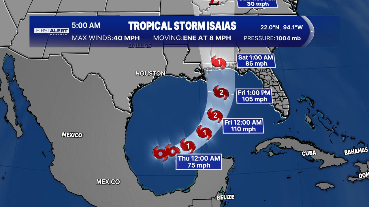


WEST PALM BEACH, Fla. — Tropical Storm Isaias formed early Wednesday morning, becoming the ninth named storm of the 2026 Atlantic hurricane season. It is forecast to become the first hurricane— and the latest the first hurricane has formed in a season since the use of modern technology.
According to the National Hurricane Center's 5 a.m. advisory, Isaias was located in the southern Gulf about 580 miles southwest of the mouth of the Mississippi River. The storm has maximum sustained winds of 40 mph and is moving east-northeast at 8 mph.

Forecasters expect Isaias to strengthen quickly over the next couple of days, with the storm forecast to become a hurricane by Thursday.
The National Hurricane Center said Isaias is expected to continue moving east-northeast Wednesday before turning northeast and north Thursday and Friday. On the current forecast track, the storm is expected to pass north of Mexico's Yucatan Peninsula on Thursday and approach the northern U.S. Gulf Coast by Friday.
No coastal watches or warnings are currently in effect, but forecasters said interests along the Yucatan Peninsula and the northern Gulf Coast should closely monitor the system. Hurricane watches could be issued for portions of the northern Gulf Coast later Wednesday.

The biggest concern for parts of the Gulf Coast could be heavy rainfall and flooding. Forecasters expect 3 to 6 inches of rain from southeastern Louisiana to the Florida Panhandle from Friday through the weekend, with localized totals up to 10 inches possible.
The National Hurricane Center warned that flash flooding, urban flooding and isolated river flooding will be possible.
Gov. Ron DeSantis signed an executive order Tuesday night declaring a state of emergency for 25 Florida counties ahead of Isaias' landfall.
TRACKING THE TROPICS: Hurricane Center | Hurricane Guide
WPTV's First Alert Weather team will continue monitoring Tropical Storm Isaias and provide updates as the forecast evolves.


