

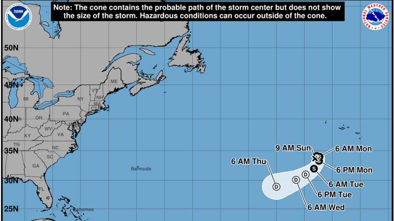


Tropical Storm Fay formed in the Atlantic Ocean Sunday morning as the system strengthened hundreds of miles southwest of the Azores.
As of the 5 a.m. EDT advisory, Fay had maximum sustained winds of 45 mph and was located about 450 miles southwest of the Azores. The storm was moving north-northeast at 5 mph.
Fay is a compact storm, with tropical-storm-force winds extending up to about 45 miles from its center.
Forecasters at the National Hurricane Center expect Fay to strengthen further Sunday, with maximum sustained winds forecast to reach 60 mph later in the day.
The storm is expected to continue moving generally north-northeast for about another day before turning toward the southwest Monday as a ridge builds to its north.
Fay's opportunity to strengthen is expected to be short-lived. Increasing wind shear and dry air are forecast to cause the storm to weaken beginning Monday.
The National Hurricane Center forecasts Fay to become a post-tropical remnant low by Tuesday and dissipate by the end of the week.
There are no coastal watches or warnings in effect, and the storm currently poses no hazards to land.
TRACKING THE TROPICS: Hurricane Center | Hurricane Guide
This story was reported on-air by a journalist and has been converted to this platform with the assistance of AI. Our editorial team verifies all reporting on all platforms for fairness and accuracy.


