WEST PALM BEACH, Fla. — Two tropical storms formed in the Atlantic within six hours Sunday: Emily in the morning in the Atlantic and Franklin in the afternoon in the Caribbean. There have been six storms so far this season with three other areas of concern in the Atlantic, Caribbean and Gulf of Mexico.
The four other named storms this season: Arlene, Bret, Cindy, Don with the latter becoming a hurricane.

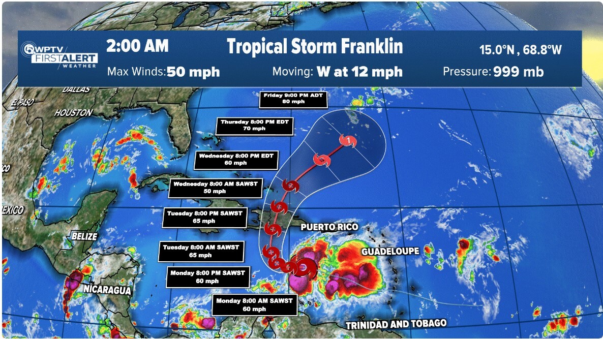
In an 11 p.m. advisory on Franklin, the National Hurricane Center said it had maximum sustained winds of 50 mph and was moving 12 mph west. Franklin was about 270 miles south-southeast Santo Domingo Dominican Republic.
Some strengthening is forecast during the next 48 hours.
A west-northwestward track is expected to continue into Monday followed by a sharp turn to the north Monday night and a northward motion is expected on Tuesday. On the forecast track, Franklin should approach the coast of Hispaniola by Tuesday night
The governments of the Dominican Republic and Haiti issued Tropical Storm Watch for the southern coasts. The storm previously was Invest 90. Before the 5 p.m. advisory, hurricane hunters found a closed low and tropical storm force winds.
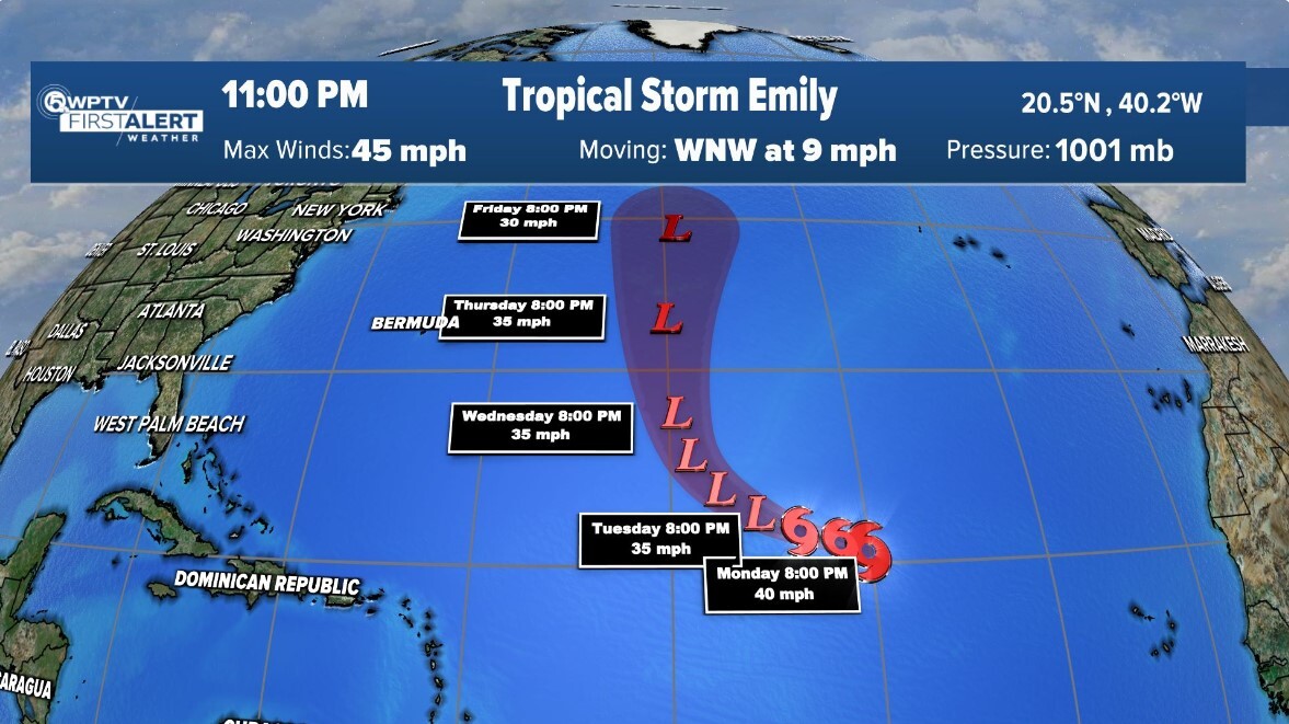
In an 11 p.m. EDT advisory for Emily, NHC said there were maximum sustained winds of 45 mph and was moving 9 mph west-northwest. Emiy was about 1,105 miles west-northwest of the Cabo Verde Islands.

A west-northwest to northwest motion is expected during the next couple of days, and a turn to the north is forecast by the middle of the week. The depression is forecast to become a post-tropical cyclone in about 36 hours.
On Saturday, it had an 80% chance of development over seven days.

Tropical Weather
FEMA expects funds to exhaust before peak hurricane season
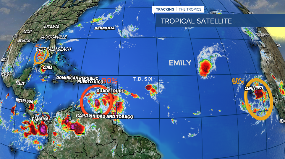
There are now three other tropical concerns, including Tropical Depression 6 that formed Saturday.

TRACKING THE TROPICS: Hurricane Center | Hurricane Guide
Tropical Depression 6, which is west of Emily, was about 500 miles east of the Northern Leeward Islands with maximum sustained winds of 35 mph. It was moving west at 9 mph. The depression is forecast to dissipate in about 24 hours.
Invest 91 had increased showers and thunderstorms Sunday night. Environmental conditions appear favorable for development of this system as it moves westward across the central Gulf of Mexico. A tropical depression or storm is likely to form as it approaches the western Gulf of Mexico coastline by Tuesday. Tropical storm formation 70% in seven days.
A large area of disorganized showers and thunderstorms over the far eastern Atlantic is associated with a tropical wave near the Cabo Verde Islands. Environmental conditions appear conducive for gradual development, and a tropical depression could form later this week while it moves west-northwestward. It has a 70% chance of development over seven days.


