


MIAMI — Hurricane season has begun and it looks like we're off to another quick start.
The National Hurricane Center tagged the disturbance in the southern Gulf of Mexico as Tropical Wave Invest 91-L.
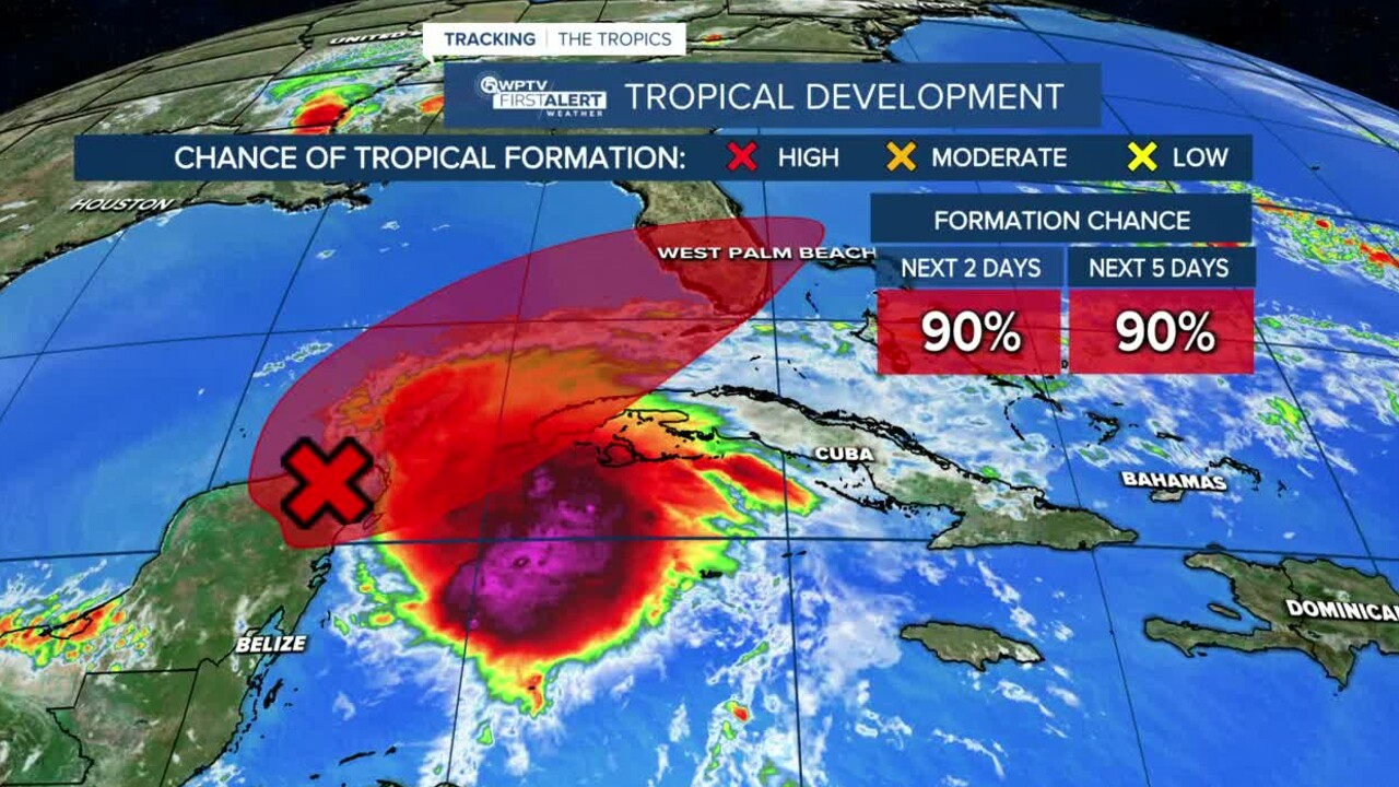
It now has a high chance of developing into a tropical depression or tropical storm over the next five days.
TRACKING THE TROPICS: Hurricane Center | Hurricane Guide
There is a 90% chance of development in the next two days and 90% within the next five days.
Agatha, this year's first named storm in the eastern Pacific, formed off Mexico's southern Pacific coast Sunday and rapidly gained power and made landfall as a Category 2 hurricane on Monday. It has since dissipated across the mountains of Mexico.
The hurricane center said the storm’s remnants seem likely to reform over the Gulf of Mexico. If it becomes a named storm in the Atlantic, it would be Alex.
The worst of the weather in South Florida is expected late Friday into Saturday.
On Friday, clouds and rain will increase ahead of a tropical disturbance. Showers and storms are expected to pick up late-Friday. Rain bands could produce heavy rain and gusty winds.
On Saturday, numerous showers, and storms across the area as the disturbance moves over Florida. Repeated rounds of heavy rainfall could lead to flooding issues. Models show improving weather conditions by Saturday evening.
The risk of excessive rainfall that could cause flooding will be highest in Broward County on Friday. That risk might spread farther north to the Palm beaches and Treasure Coast Friday night and Saturday morning. Too soon to say where that cutoff will be just yet. pic.twitter.com/gRqlY1YI0B
— John Gerard (@JGerardWeather) June 2, 2022
The National Hurricane Center is also watching an area north of the Bahamas which has a low chance of development over the next 5 days as it moves away from the U.S.


