


WEST PALM BEACH, Fla. — We are looking dry with only a few clouds overhead for the remainder of the night. Lows will fall into the mid 70s in the Treasure Coast and inland with the Palm Beaches at or just below 80.
MORE WEATHER: Radar | Alerts | 7-Day Forecast | Hourly Forecast
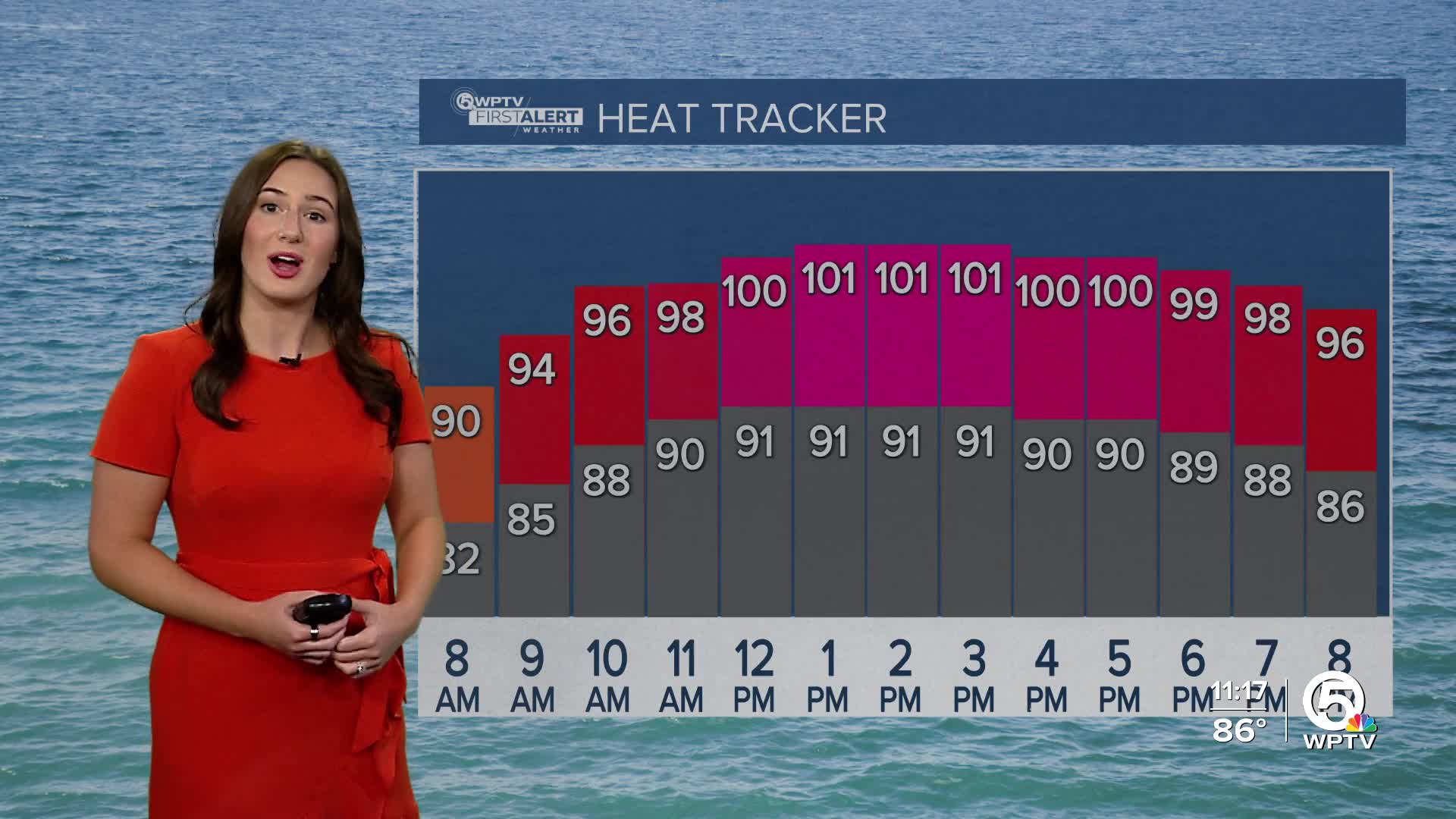
Sunday will be another day battling heat and humidity. It starts off with plenty of sunshine and temperatures heating up. Highs will head into the lower to middle 90s. Heat indices will once again be in the triple digits with Palm Beach County between 105-110 in the afternoon. Spotty storms will develop along the sea breeze in the late afternoon, but rain will be limited.
Next week will be more active on the radar.

We are tracking a low pressure system that will stall along the Florida-Georgia line. This will increase our instability and our rain chances. We are expecting scattered-widespread storms each afternoon next week, starting on Monday.
Later in the week, high temperatures will dip slightly to the upper 80s. It will still be very hot and humid in the morning ahead of the afternoon storms. This will hopefully help out with our yearly departure sitting between 6 inches to a foot of needed rain.
TROPICS
The National Hurricane Center is keeping an eye on two areas in the Atlantic. A non-tropical low pressure system has formed off the North Carolina coast. It could gain brief tropical or subtropical characteristics as it drifts east-northeast away from the U.S. By Monday, conditions are expected to be less conducive for further development. The chances for it to develop into a tropical system are low — just 30% in the next week. No local impacts are expected!

The other area has been highlighted due to a tropical wave expected to move off Africa in the next day or so. We will be monitoring the wave for tropical development towards the middle or latter part of next week while it moves west-northwest. At this time, there is no threat to Florida.


