
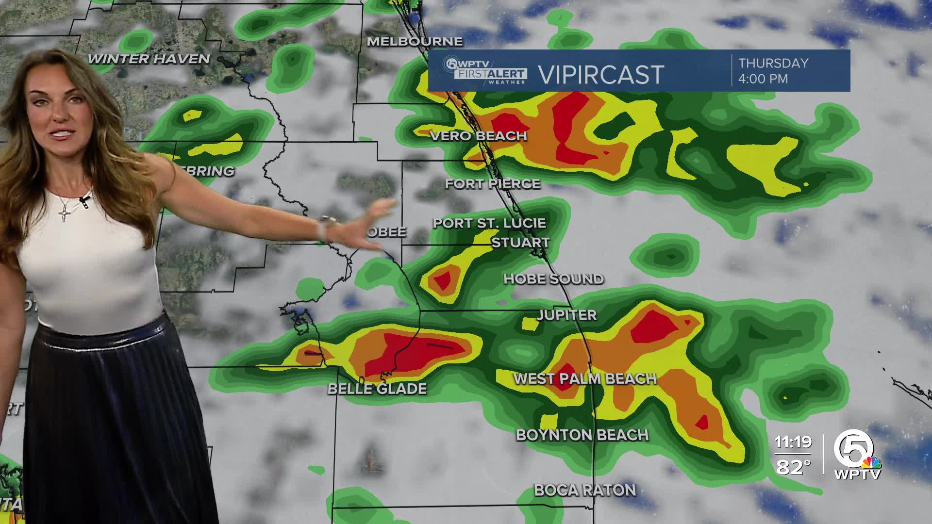


WEST PALM BEACH, Fla. — Thursday and Friday bring higher rain chances as a cold front moves into Florida. Moisture increases, and rain chances jump to 40–70% with more widespread showers and storms, especially along the coast. A few areas could see locally heavy rain.
MORE WEATHER: Radar | Alerts | 7-Day Forecast | Hourly Forecast
Highs will be dropping back to the mid-80s. Onshore winds strengthen again, blowing 10–20 mph with gusts up to 25 mph, keeping the coastal flooding risk elevated or even worsening.
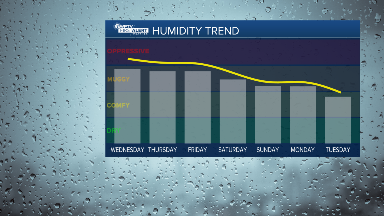
Saturday through early next week, a non-tropical low offshore will keep winds breezy and beach/marine hazards in play, but drier air arrives Sunday. This will drop rain chances to near zero and bring a more fall-like feel with humidity, and overnight lows may even dip into the 60s with highs in the low/mid 80s!
Key points:
-Dangerous beach and marine conditions will continue all week, including coastal flooding, life-threatening rip currents, rough surf, and beach erosion (especially near high tide).
-Breezy and gusty onshore winds persist through much of the week.
-A late-weekend cold front ushers in a fall-like airmass by Sunday, with less hot, drier air.


