


WEST PALM BEACH, Fla. — Flooding will be the greatest threat to South Florida on Tuesday and Wednesday as periods of extremely heavy rain are expected, especially as we head into overnight.
WPTV First Alert Weather meteorologist James Wieland said heavy downpours are expected throughout Palm Beach County and the Treasure Coast, and as far inland as Lake Okeechobee.
"All of us are going to see some sort of action on that radar this afternoon," Peyton said. "As we get into the evening, it does become more scattered in nature. But it is going to be a busy day and busy week in town."
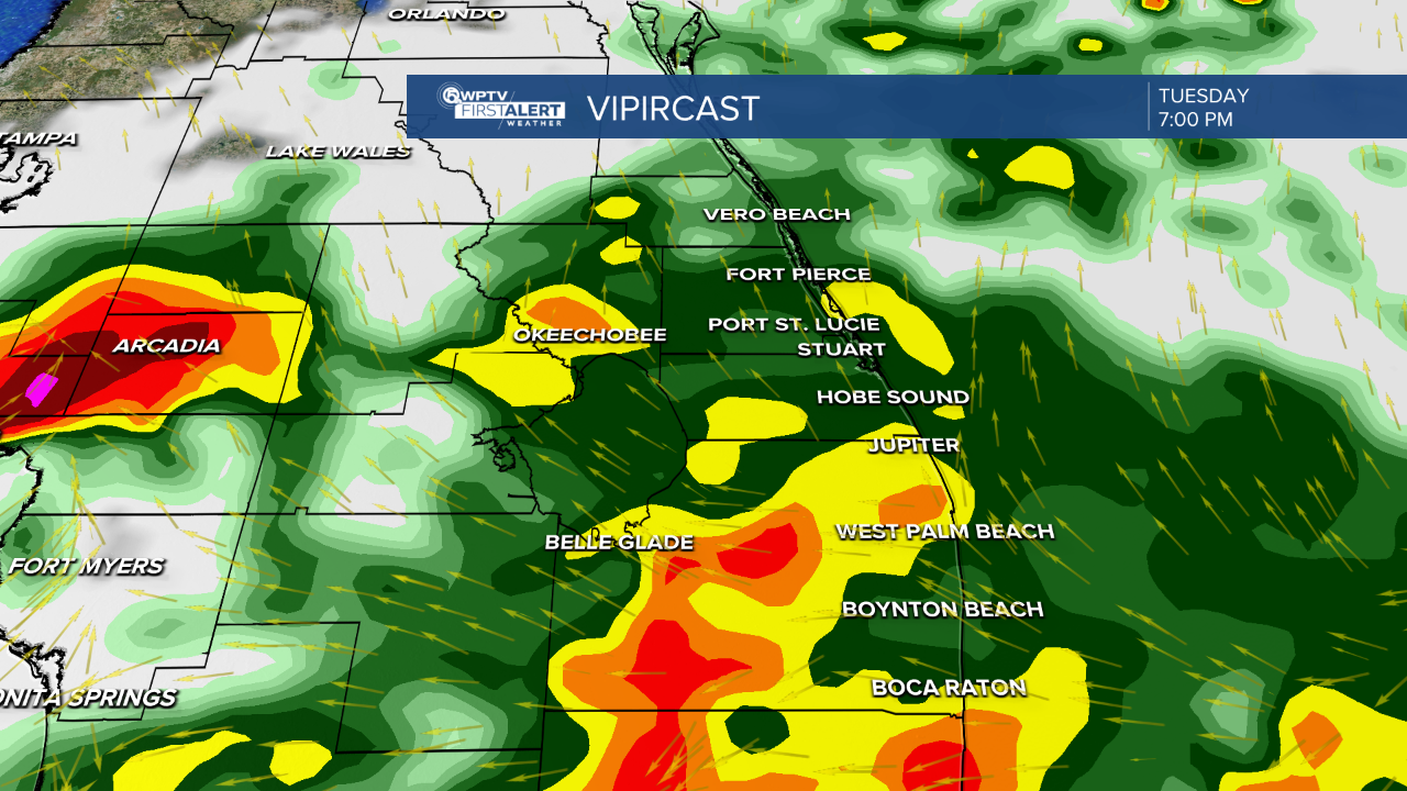
A flood watch is in effect for Palm Beach County through Wednesday due to the potential of 2" to 5" of rainfall in a 24 to 48-hour period.
Other counties that aren't included in this warning should still be on high alert for flooding issues across the area.

MORE WEATHER: Radar | Alerts | 7-Day Forecast | Hourly Forecast
The rain won't quit anytime soon!
We will experience drought-busting numbers with rainfall totals between 4" to 6" with locally higher totals by the weekend.
Something to keep in mind when driving on the roadways: It can take 12 inches of rainfall to hydroplane and sweep a small car away. It is very important to remember, "Turn around, don't drown."

The rain will keep temperatures cooler than average. Highs stay in the mid 80s for most of this week and very muggy, too.
Over the weekend, temperatures try to warm to the mid 80s, despite storm chances over the weekend.
Stay safe everyone!


