

It's that time of year when you're either in Florida anxiously waiting for your next cold front or elsewhere in the country wishing the cold fronts would give you a break. We wait with anticipation for our first cold front to make it all the way to south Florida every summer signaling our first taste of fall.
But what is a cold front exactly? Or a "cool" front which is what we experience more often during fall in Florida.
A cold front marks the boundary between a colder, drier air mass and a warmer and/or more humid air mass. The colder air is often referred to as a continental polar air mass because it originates in cold, northern, inland areas. The air mass keeps the characteristics of its source area, which means much drier, cooler air behind the passage of a cold front.

A cold front often marks a high chance for storms as well. The cold, dry air behind the front is more dense than the warmer, more humid air ahead of the front. This allows the cold front to quickly lift the warm, humid air. This provides all the ingredients needed for unstable weather. The more intense the difference in pre and post frontal air, the more intense the storms will likely be. This is why we often see storm outbreaks along a frontal boundary.
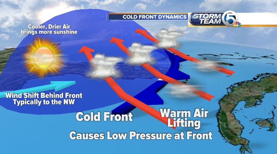
Once the front has moved through an area a change in the weather is felt soon after. Most often winds shift from a more southerly/southwesterly direction to coming from the northwest ushering in much cooler drier, air.

You can easily pick a strong front out on a current temperature or dew point map. Temperatures behind the front will be colder and dew points will be drier. This is why a cold front is such a welcome change in south Florida, its often followed by low humidity, pleasant temperatures and sunshine.


